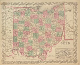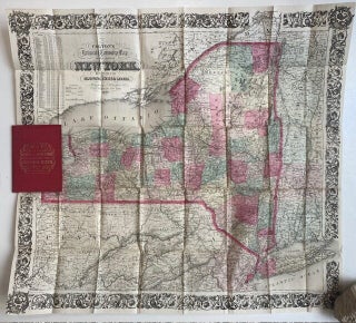
Colton's Railroad & Townshp Map of the State of New York with parts of the adjoining states of Canada.
New York: J. H. Colton, 1863. Pocket map. Engraving with original hand coloring. Image measures 28" x 25". 16mo cloth, with title stamped in gilt on front board. Classic 1863 pocket map of the the State of New York, issued by Colton. Shows the entire state in incredible detail with particular attention to the roads and railroads. Color coded by county, cities, rivers, lakes, towns, and other topographical features are also noted. Population statistics are included in the top left..... More