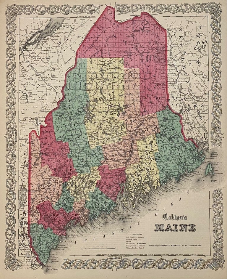
Colton's Maine
Johnson & Browning, 1859.
Map. Engraving with original hand coloring. Image measures 15 3/4" x 12 3/4"
Nicely detailed map of Maine divided into counties and townships. Shows towns and cities, railroads, major routes, waterways and canals. In very good condition. Several closed tears at margins, and toning at edges. Otherwise clean and bright.
The Colton family was one the most prolific and successful publishers of maps and atlases in the United States. J.H. Colton (1800-1893) founded his business in NYC in 1831.
Alvin Jewett Johnson (1827-1884) is one of the most prolific American publishers of the 19th century. He opened his own company in 1856 that produced atlases, maps and encyclopedias. The company made great maps based on those by J.H. Colton and Johnson produced a newly updated version every year up until the late 19th century.
Binding: Unbound
Language: English
Price: $100.00
Item #310392