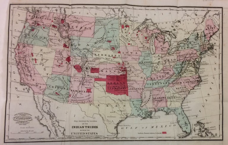
Map showing the location of the Indian Tribes within the United States; Prepared to accompany the Manual of Missions
New York: J.H. Colton, 1868.
Map. Lithograph with hand coloring. 8.75" x 13". In very good condition.
Early map of the United States with vivid red index noting Indian Reservations. The history of Native Americans in the United States is a long and arduous one, and this map shows a punctuated moment following the Indian Removal Act, the Trail of Tears, and Indian Appropriations Act, which created the Indian Reservation System, shown in red. It's important to note that all the reservations on the map, save for a few small ones in Wisconsin, are west of the Mississippi River. The Colton family was one the most prolific and successful publishers of maps and atlases in the United States. J.H. Colton (1800-1893) founded his business in NYC in 1831.
Binding: Unbound
Condition: Very Good
Language: English
Price: $650.00
Item #288978