
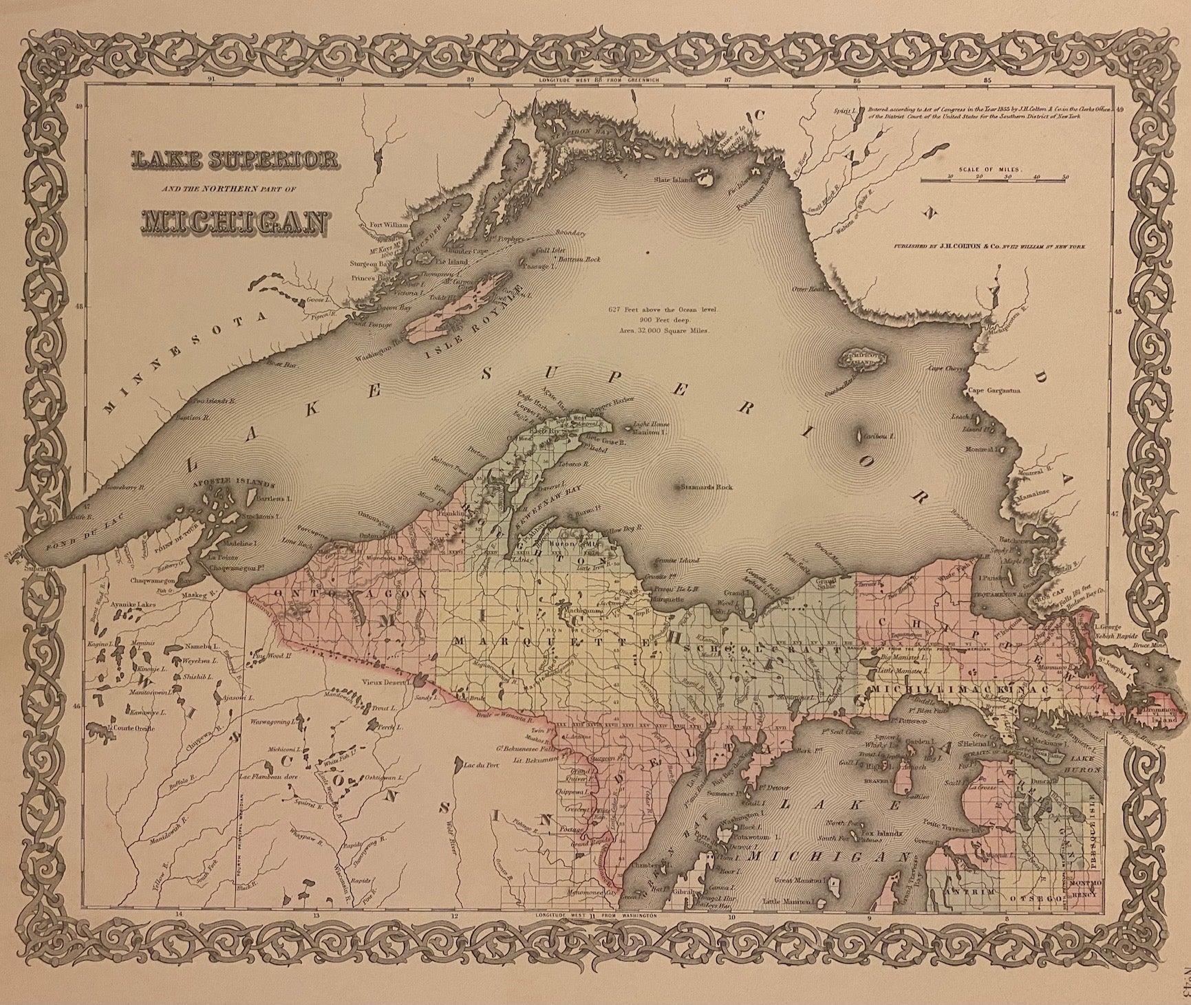
Lake Superior and the northern part of Michigan
New York: J.H. Colton, 1855.
Map. Engraving with original hand coloring. Image measures 13" x 16 1/4"
Beautifully detailed map of Lake Superior and northern Michigan divided into counties. Shows public land survey plats, towns, waterways, islands, topographical features, and mines. In excellent condition.
The Colton family was one the most prolific and successful publishers of maps and atlases in the United States. Joseph Hutchins Colton (1800-1893) founded his map publishing business upon moving to New York in 1831. For the first two decades of his business, he found immense success publishing guide books marketed to emigrants and tourists. In 1855, he published the firm's first original atlas, "Colton's Atlas of the World", in collaboration with his son, George W. Colton (1827-1901). George and his brother, Charles B. Colton (1832-1916), assumed direction of the firm in the following decade.
Binding: Unbound
Language: English
Price: $125.00
Item #310761