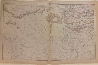
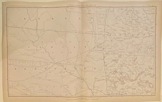
The Atlas to Accompany the Official Records of the Union and Confederate Armies, 1861-1865: Plate X...Arkansas & Tenn.
New York: Julius Bien & Co., 1895. Map. Color lithograph. Sheet measures 18 1/2" x 29 1/2" Collection of inset maps depicting the positions of both Union and Confederate armies during the Battle of Pea Ridge, the Battle at Shiloh, and more. The largest map on the page depict a portion of the Mississippi River where rebel armies built fortifications as well as how the Union attacked those forts. Beyond this historical information, the map is highly detailed in itself..... More