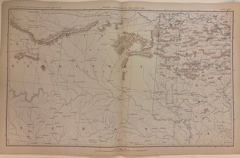
General Topographical Map, Sheet XXIV
New York: Julius Bien & Co., 1895.
Map. Color lithograph. Sheet measures 18 1/2" x 29 1/2"
This map appeared as Plate CLX in "The Atlas to Accompany the Official Records of the Union and Confederate Armies, 1861-1865." It depicts the border region of Oklahoma (Indian Territory), Arkansas, and Texas. The area labeled as Indian Territory is subdivided by nation - showing Cherokee, Creek, Quapaws, Senecas and Shawnees, and Senecas Proper. The map is highly detailed, with cities, rivers, towns, post offices, villages, railroads, and forts labeled. Swamps are depicted pictorially, and relief is shown by hachure. Map is in excellent condition. Folded as issued.This map wonderful piece that boldly documents American history.
Julius Bien (1826-1909) was an American lithographic printer and cartographer based in New York City. During the course of the second half of the 19th century, he produced thousands of maps for both public and private publishers. Some of his most notable commissions were for the U.S. government, including many geological maps that redefined the cartographic visualization of geology. Bien's prolific output and contributions to the development of chromo-lithography make him one of the most significant map printers of his time. This is a great example of his fine work.
Binding: Unbound
Language: English
Price: $275.00
Item #304887