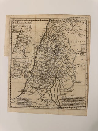
La Palestina per L'Istoria degl' Imperatori Romani del Sigr Crevier del Sigr D'Aville
Map. Uncolored engraving. Image measures 13 3/8" x 11 3/4" This scarce edition of D'Anville's map of Palestine was published in volume 7 of Jean-Baptiste Louis Crevier's "Storia degli Imperatori Romani" or "The History of the Roman Emperors," first printed in 1750. The map, based on D'Anville's work, depicts the region comprising modern day Palestine, Israel, Jordan, and Lebanon. Regions, cities, rivers, and lakes are labeled according to Roman place names. Mountains are rendered pictorially. Two insets in the left..... More