
Between Continents/Between Seas: Precolumbian Art of Costa Rica.
New York: Abrams, 1981. Illustrated abundantly in color and in black and white. 240 pages. 4to, pictorial wrappers (lightly sunned at spine). New York: Abrams, (1981). Near fine. More
New York: Abrams, 1981. Illustrated abundantly in color and in black and white. 240 pages. 4to, pictorial wrappers (lightly sunned at spine). New York: Abrams, (1981). Near fine. More
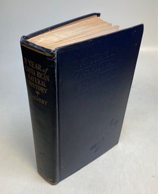
New York: Macmillan, 1917. Frontis. in color, many b/w illus. xix, 577pp. 8vo, blue cloth, corners bumped, cloth lightly soiled. New York: Macmillan, 1917. First Edition. More

Costa Rica: Fundacion Museos Banco Central, 2005. Illustrated profusely in color. 119 pages. Text in English and Spanish. Oblong 4to, blue pictorial boards, d.w. (edgeworn). Costa Rica: Fundacion Museos Banco Central, (2005). A very good(+) copy -- minorn bumping at corners -- in a very good(+) dust wrapper. More
Pittsburgh: Carnegie Institute, 1907. 47 plates including folding map. 188pp. Folio, contemporary 1/2 green cloth with leather spine label, original wrappers bound in, small area of wear on front marbled board, spine label rubbed, edges of corners worn. Pittsburgh: Carnegie Institute, 1907. Each plate has multiple objects depicted. Internally, a tight bright copy. Memoirs of the Carnegie Museum, Vol. III. No. 1. More
Edmonton: Lone Pine Publshing, 1996. Illus. 8vo, pr. wrs. (Edmonton): Lone Pine Publshing, (1996). Very good. More
San Jose: Trejos Hermanos Sucesores, 1996. Color Illus. 4to, blue boards, d.w. chipped. (San Jose): Trejos Hermanos Sucesores, (1996). More

Leiden: Van der Aa, Pierre, 1729. Map. Original uncolored engravings. Published in Leiden, 1729. Image measures 11 1/4" x 14". Finely engraved map of Mexico and Central America. Beautifully detailed, the map labels regions, towns, rivers, lakes, and coastal features. Mountains are depicted pictorially. Includes parts of Florida and Cuba. Features an elaborate title cartouche in the lower left corner. A dark and crisp impression. In very good condition, with very minor damp stains to top margin, not affecting the..... More

Leiden: Van der Aa, Pierre, 1713. Map. Engraving with full hand coloring. Image measures 11 1/4" x 14 1/4". Finely engraved map of Mexico and Central America extending from Tampico to Panama City. The map depicts regions, towns, churches, rivers, lakes, and coastal features in impressive detail. Mountains, volcanoes, and forests are depicted pictorially. Mexico City is depicted on the northern bank of Lake Texcoco. Includes part of western Cuba. In very good condition with minor damp-staining to upper margin..... More
I wanted to thank you for the quality of this product as well as the way it was shipped. Not only did it arrive prior to the estimate but it was carefully wrapped. It is appreciated.
I just wanted to let you know that I received the book, Quality Street, with its stunning scenic inlaid binding by Birdsall. I LOVE this book! It arrived safe and sound, thanks to your careful packing. Thank you for your good care throughout my order.