
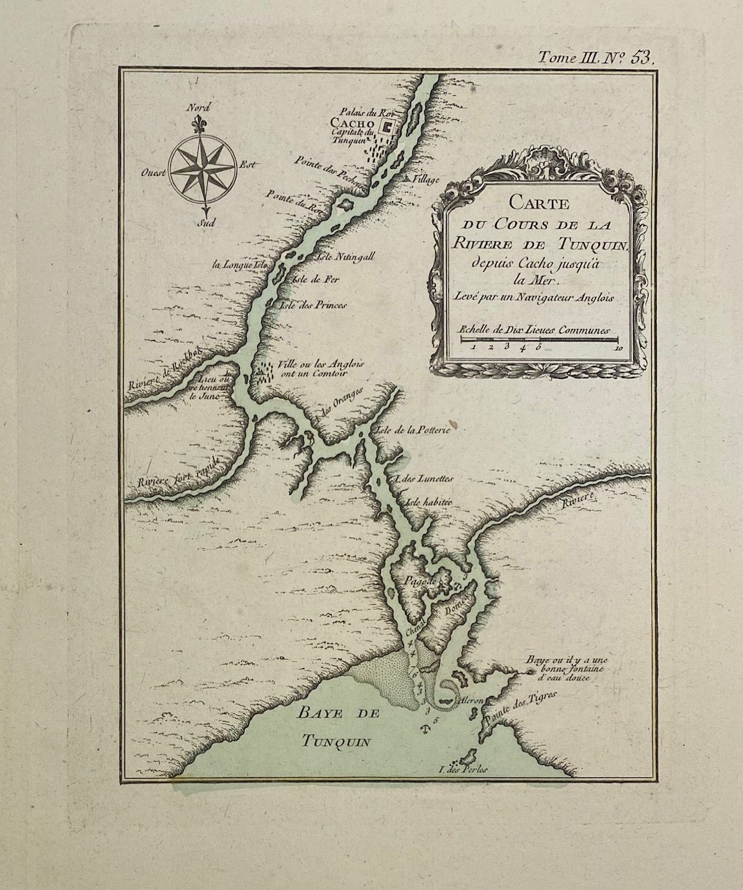
Carte du Cours de la Riviere de Tunquin
Paris: Bellin, Nicolas, 1764.
Map. Copper plate engraving. Uncolored. Image measures 8" x 6"
This impressive map or sea chart details the mouth of the Tonkin River [Red River] in Vietnam. The map extends from the capital city of Cacho to the Bay. Notations describe settlements and topography along the river, with depths by soundings in the entrance. Issued in Bellin's "Le Petit atlas maritime". In excellent condition, full margins as issued.
Jacques Nicolas Bellin (1703-1772), was the official hydrographer to the French king and the first person to hold the title of "Ingenieur de la Marine of the Depot des cartes et plans de la Marine" (chief engineer of the French Hydrographical Office).
Binding: Unbound
Language: English
Price: $125.00
Item #315078