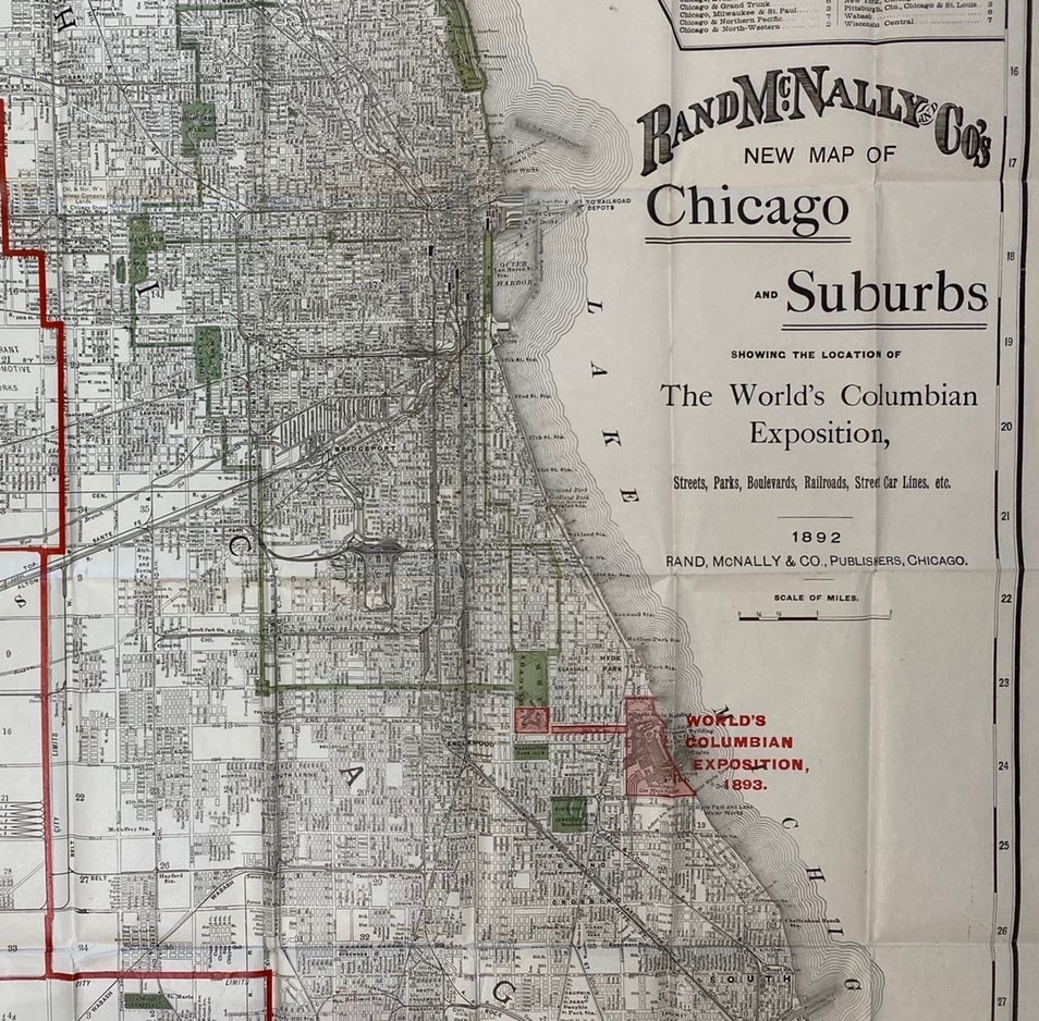
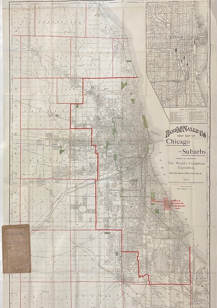
New Map of Chicago and Suburbs showing the location of the World's Columbian Exposition
Rand McNally, 1892.
Map. Color lithograph. Sheet measures 41 3/4" x 27 1/2"
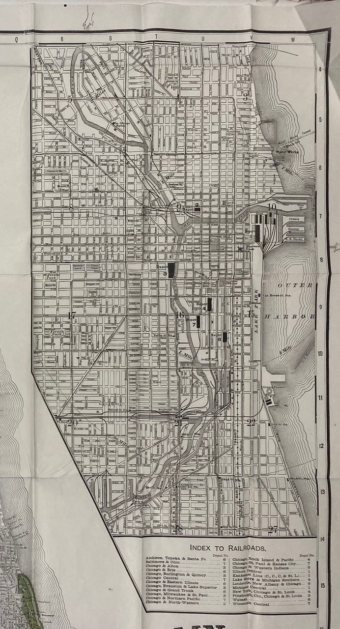
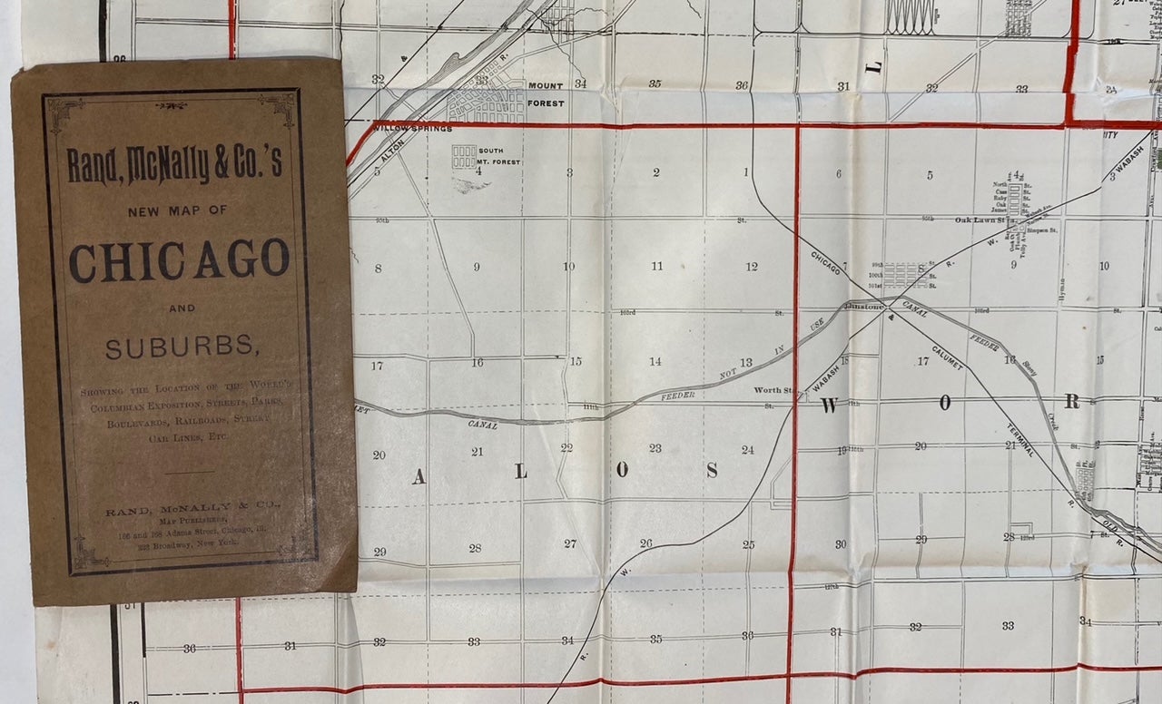
Large and bold map of Chicago published in 1892 in anticipation for the world's fair in Chicago held in 1893. Extending from Winnetka to East Chicago, the map shows streets, railways, and street car lines. At inset in the upper right corner depicts a larger scale map of downtown Chicago, with an index to railroads. Parks and cemeteries are colored in green, and red overprint delineating townships, and highlighting the location of the fair. In excellent condition, with folds as issued. Original booklet cover attached.
Rand McNally is an American publishing company specializing in maps, atlases and globes. Founded by William Rand in 1856, who hired Andrew McNally in 1858 to work in his shop. The two men formally established Rand McNally & Co. in 1868. The firm remains in business today. This is a great example of their work.
Language: English
Price: $565.00
Item #314636