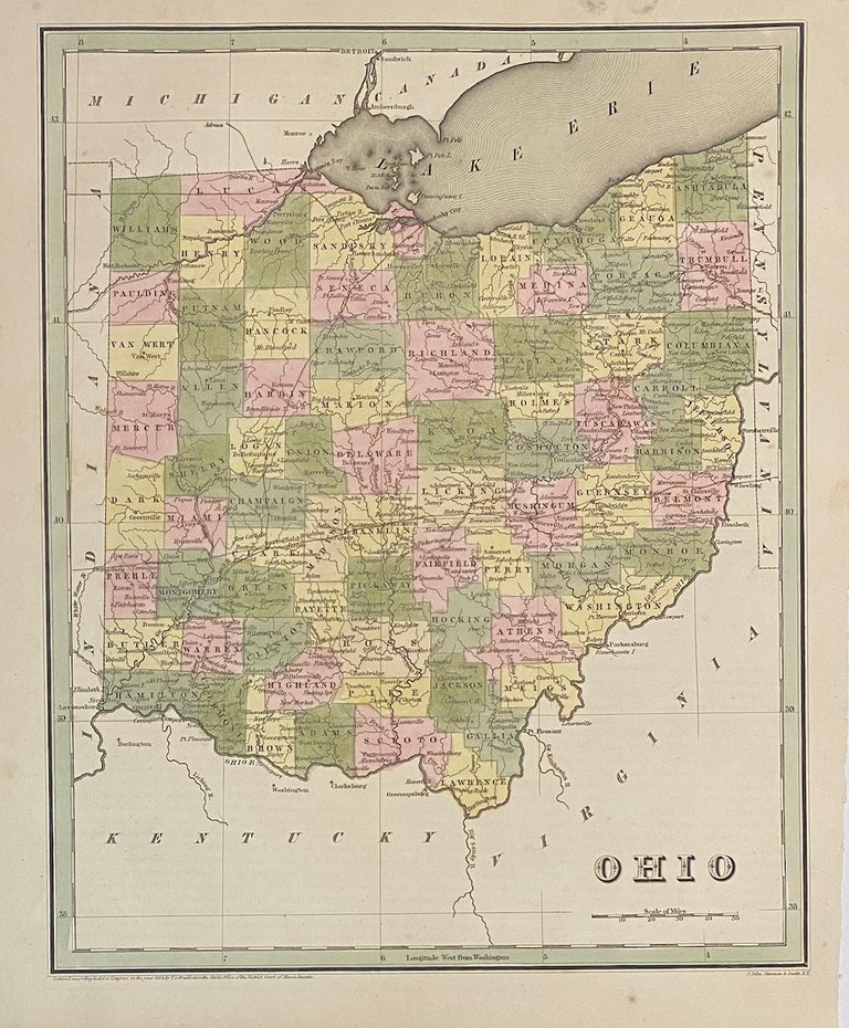
Ohio
Boston: T.G. Bradford, 1838.
Map. Engraving with original hand coloring. Image measures 14" x 11 1/4".
Nice early map of Ohio divided into counties and townships showing major routes, railroads and geographical details. This is the first edition of this map. published in 1838. In very good condition. Minimal foxing to margin, not affecting the image.
T.G. Bradford (1802-1887) was a Boston based publisher. He worked as assistant editor of the American Encyclopedia before entering the field of map making. He was best known for his 1835 "A Comprehensive Atlas: Geographical, Historical & Commercial" and his 1838 "Illustrated Atlas Geographical, Statistical and Historical of the United States and Adjacent Countries", both of which proved to be important contributions to American cartography.
Illustrator: S. Stiles, Sherman and Smith
Binding: Unbound
Language: English
Price: $250.00
Item #313491