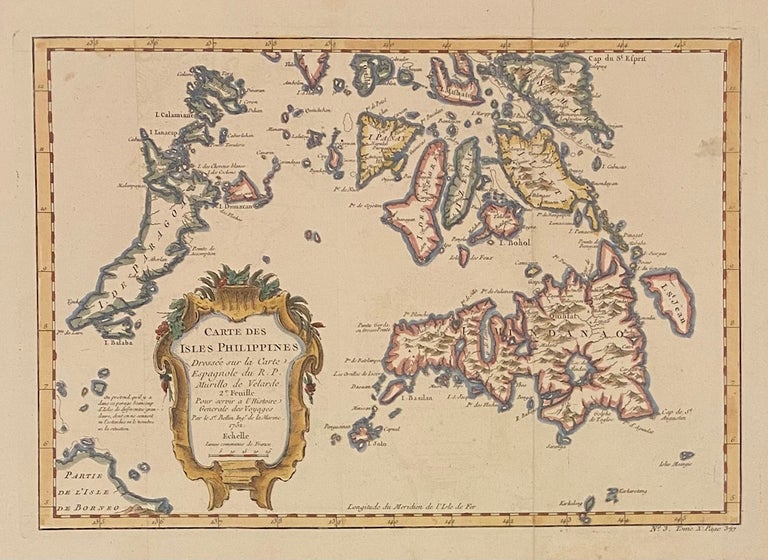
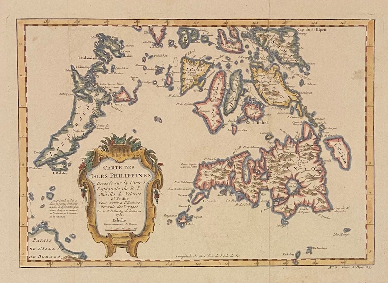
Carte Des Isles Philippines 2e Feuille
Paris: Bellin, 1764.
Map. Engraving with hand coloring. Image measures 8 3/8" x 11 5/8"
This map of the southern Philippines depicts the Visayas, Mindanao, Calamianes, Palawan, and part of Borneo. A lovely Baroque cartouche adorns the map. As noted in the title, this map was made after a seminal 1734 map by the Spanish Jesuit missionary and cartographer, Pedro Murillo de Velarde. Mountains are rendered pictorially, and cities, towns, islands, and coastal features are labeled. From "Le Petit Atlas Maritime: Recueil de cartes et plans des quatre parties du monde en cinq volumes, Vol. III", published in 1764. Hard to find.
Jacques Nicolas Bellin (1703-1772) was the official hydrographer to the French king and the first person to hold the title of "Inginieur de la Marine of the Depot des cartes et plans de la Marine" (chief engineer of the French Hydrographical Office). He was particularly well-known for his maps of the French Empire. This map is a fine example of his detailed work.
Language: English
Price: $300.00
Item #312814