
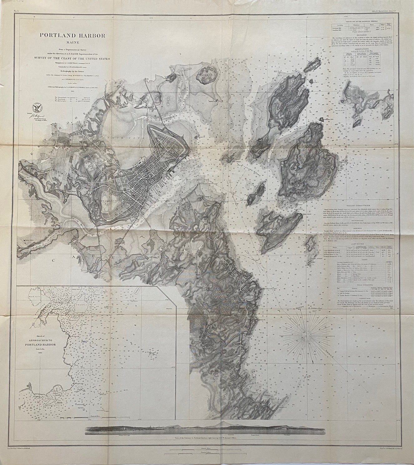
Portland Harbor
Washington: Government Printing Office, 1862.
Sea chart. Uncolored lithograph. Image measures 38" x 26 1/4"
Beautiful sea chart of Portland Harbor in Maine featuring a town plan of the city of Portland, and dramatically rendered topographical detail. Includes Peaks Island, Cushing Island, and other islets. An inset in the lower left depicts "Approaches to Portland Harbor", showing Cape Elizabeth and surrounding waters, with depths by soundings. An elevation view at the bottom depicts the "View of the Entrance to Portland Harbor". In very good condition. Minor toning along original fold lines, and some wear to margins.
Alexander Dallas Bache (1806-1867) was an incredibly prolific surveyor, who worked as the superintendent of the United States Coast Survey. Minor aging along original folds. Partial border missing on left side of each sheet, though the losses appear to be original.
Binding: Unbound
Language: English
Price: $675.00
Item #312436