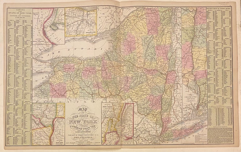
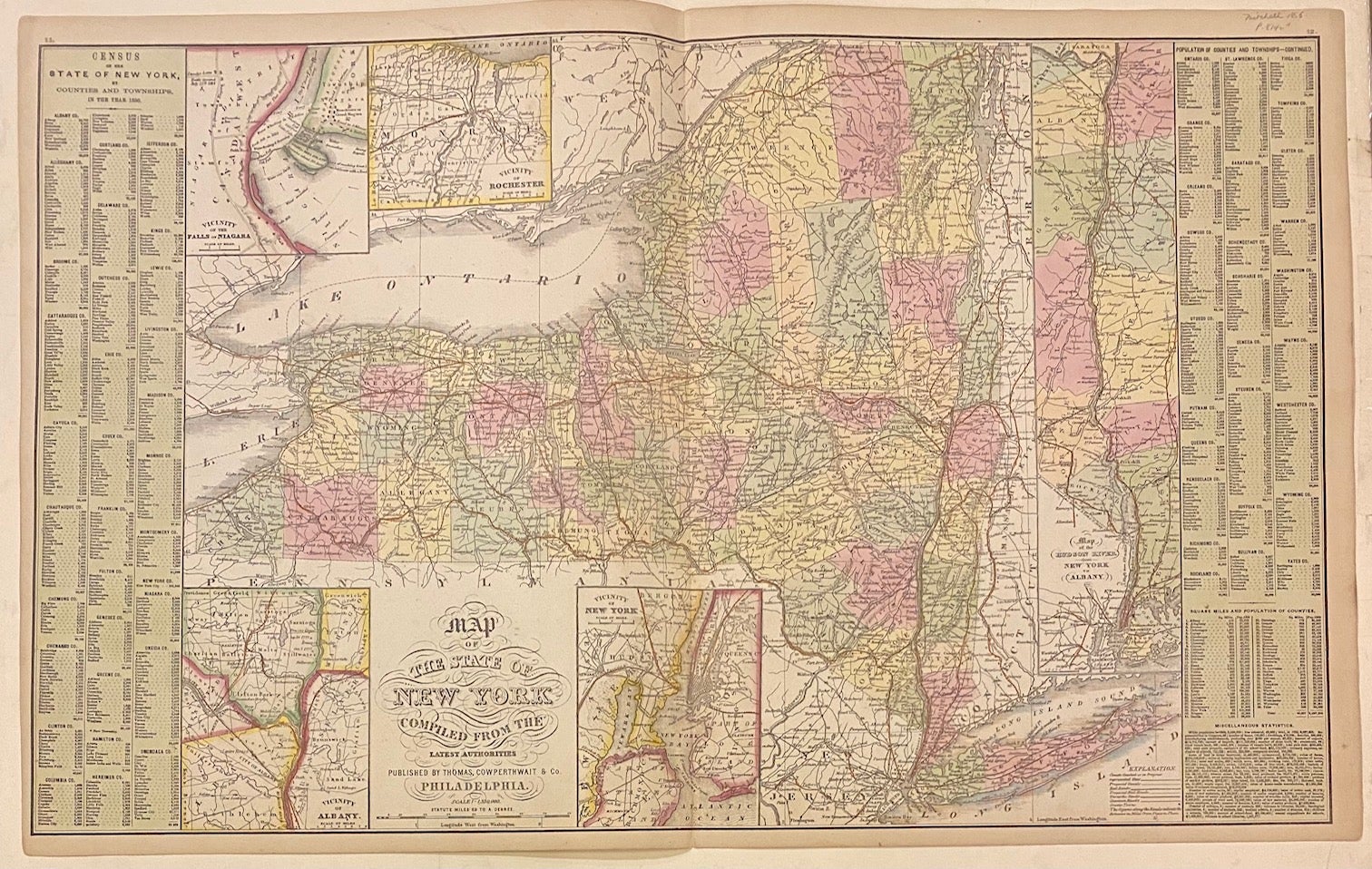
Map of the State of New York compiled from the latest authorities
Philadelphia: Desilver, Charles, 1855.
Map. Engraving with original hand coloring. Image measures 16 1/8" x 26 1/4"
Fascinating map of New York divided into counties. Shows towns, major routes, railroads, waterways, and topographical features. Insets include the vicinities of Albany, New York City, Rochester, and Niagara Falls, and a Map of the Hudson River from New York to Albany. On either side of the map is a table listing populations of counties and townships, square miles of counties, and other miscellaneous statistics. From the "New Universal Atlas". Plate was originally published by Samuel Augustus Mitchell, who sold the copyright to Thomas, Cowperthwait & Company in 1850, which was in turn bought by Charles Desilver in 1856.
Thomas, Cowperthwait & Co. took over publication of S. A. Mitchell's important "Universal Atlas" in 1850, and continued to produce updated maps that were considered some of the best commercial cartography of the 19th century.
Binding: Unbound
Language: English
Price: $165.00
Item #312188