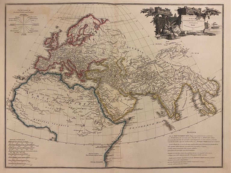
Orbis Veteribus Notus
London: James Wyld, 1853.
Map. Engraving with hand colored outline. Image measures 18 1/2" x 24 1/2"
A lovely map of the "Old World", showing Europe, northern Africa, and western Asia. The map was made by D'Anville and published by James Wyld in 1853. Elegantly rendered on a globular projection, with an elaborate title cartouche featuring stunning architectural detail, two classical figures, and a sail boat in the distance.
James Wyld Sr. (1790-1836) was a distinguished British mapmaker known for producing maps and globes. He served as Geographer to George IV and William IV. He was a founding member of the Royal Geographical Society and introduced lithography techniques to his production. His son James Wyld Jr. (1812-1887) was the official geographer to Queen Victoria.
Jean Baptiste Bourguignon d' Anville (1697-1782) was a French geographer and cartographer whose accurate, research-based work raised the standards for 18th-century map-making. Passionate about maps from his childhood, he created maps during his school years and would go on to publish several atlases during his prolific career. In his early 20's he became the Geographer to the King of France. His accuracy and in depth research would make him one of the most important cartographers of the 18th century.
Binding: Unbound
Language: English
Price: $375.00
Item #312001