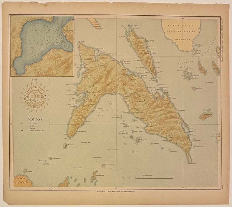
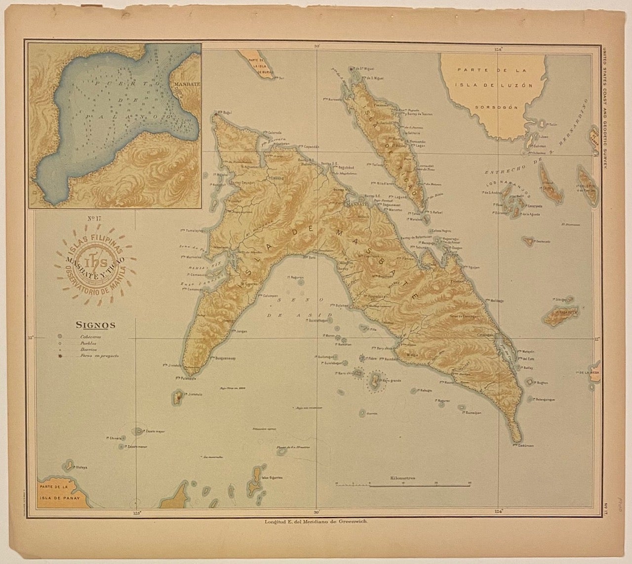
No. 17 Masbate y Ticao. Islas Filipinas Observatorio de Manila
Washington: Government Printing Office, 1900.
Map. Color lithograph. Image measures 13 1/2" x 11 1/2"
This map depicting the islands of Masbate and Ticao was originally prepared as part of a series made by the Manila Observatory of the Jesuits in 1899. Led by director P. Jose Algue, the Observatory employed only native Philippine draftsmen to complete the technical work required for the project. Upon learning of the Jesuits' undertaking, the U.S. Coast and Geodetic Survey entered into cooperation with the Observatory to produce a comprehensive atlas of the Philippine archipelago. The 30 maps were then brought to the U.S., redrawn slightly with regards to scale and projection, and published by the Survey in 1900 as the "Atlas of the Philippine Islands," the third edition in a series of special publications. This unique combination of American command and a wholly Spaniard or Filipino staff made the Observatory a rare example of cooperation during the period of the Philippine-American War, which continued from 1898 to 1902. Furthermore, the project is significant in its own right given the historic difficulty of mapping the islands, owing in particular to constant disputes between the warring imperial powers of Spain and Portugal. As the superintendent of the Survey describes in the atlas's introduction, the Jesuits spared no pains in securing all available data, and verified them by consultation with members of other religious orders, as well as with old residents, travels, and explorers.
The map depicts the islands of Masbate and Ticao, as well as surrounding islands and sand bars. Topography is artistically rendered, and rivers, cities, towns, and lighthouses are labeled. An inset in the upper left shows the Port of Palanog, with depths by soundings. The map is in excellent condition with vibrant color. Small binding holes to upper margin, not affecting the image.
The U.S. Coast and Geodetic Survey was first established in 1807. After the Civil War, the bureau took responsibility for mapping and conducting geodetic surveys of the the interior of the expanding country. The beautiful quality of this map of the Philippines, particularly with regard to geodetic detail, attests to the fascinating history and hard work that lay behind it.
Language: Spanish
Price: $145.00
Item #310144