
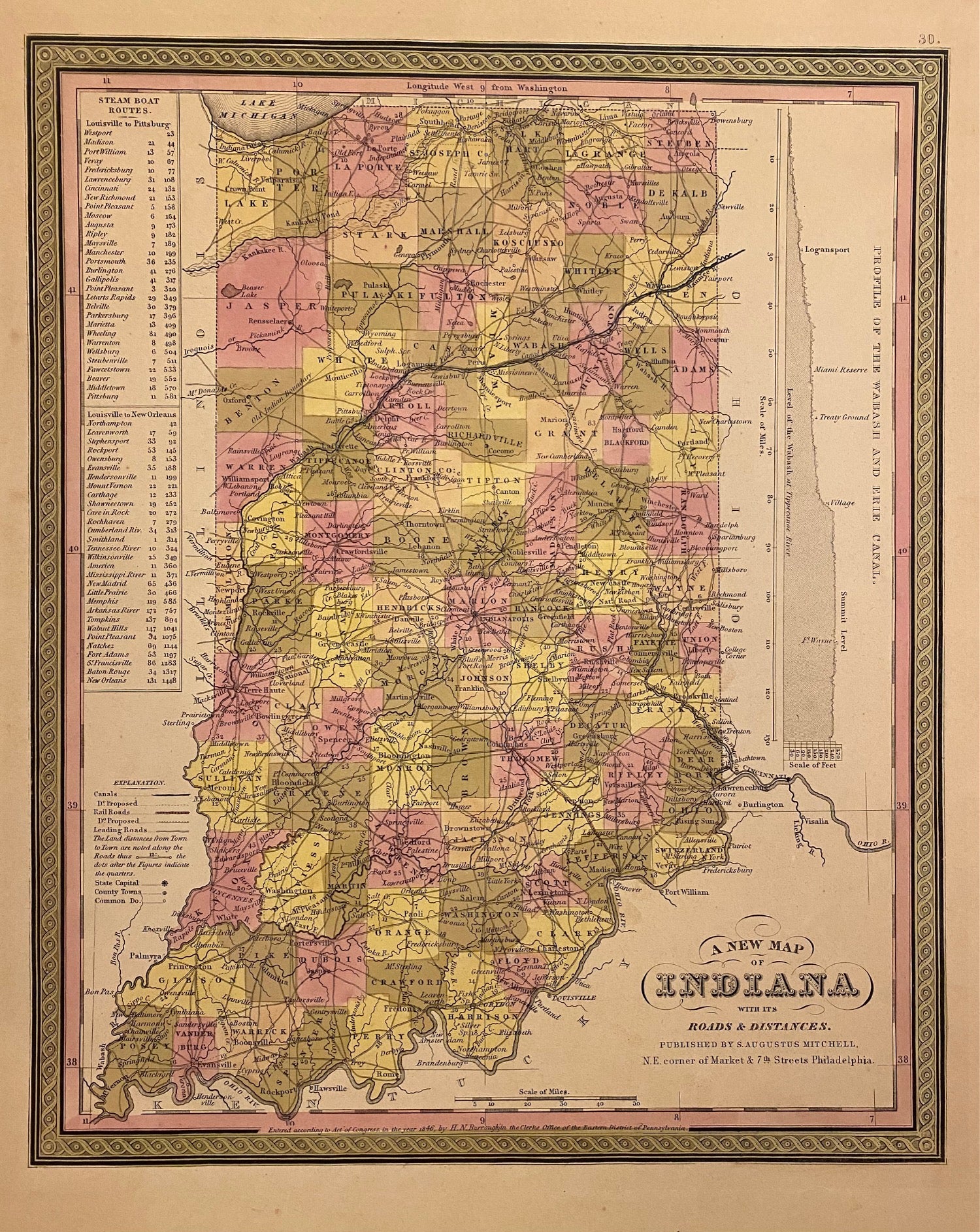
A New Map of Indiana with its Canals, Roads & Distances
Philadelphia: H. N. Burroughs, 1846.
Map. Lithograph with original hand coloring. Image measures 14 3/8" x 11 7/16".
Classic map of Indiana divided into counties. The map includes towns and roads, in addition to canals, drawn in blue, and railroads, drawn in red. A table in the upper left shows steamboat routes from Louisville to Pittsburgh and to New Orleans. An elevation view on the right shows a profile of the Wabash and Erie Canal. The map is in good condition, with only minor chips and tears to edges, not affecting the image.
Samuel Augustus Mitchell Sr. (1792-1868) published this map as part of the first edition of his seminal New Universal Atlas. Mitchell is one of the pioneers in American cartography of the 19th century and led the conversion of engraved map plates to more affordable lithographic plates.
Binding: Unbound
Language: English
Price: $150.00
Item #310093