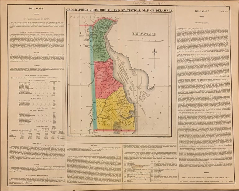
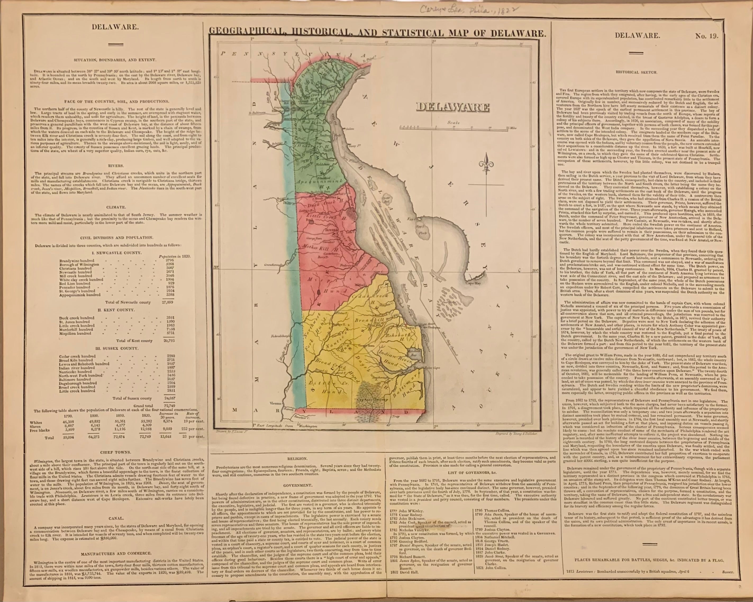
Geographical, Historical and Statistical Map of Delaware.
Philadelphia: Carey & Lea, 1822.
Map. Engraving with original hand coloring. Map measures 11.75" x 9.75", map plus text measures 16.75" x 21".
Fine antique map of Delaware divided into counties, showing towns, major routes and waterways. Includes information pertaining to history, climate and demographics. From "A Complete Historical, Chronological, and Geographical American Atlas..." of 1822. Condition is very good, stain in Governors list.
The Philadelphia-based firm of Carey & Lea of Philadelphia was one of the most important publishers in the early 19th-century United States. Run by Henry Carey (1793-1879) and Isaac Lea (1792-1886), the company worked with both books and maps, specializing particularly in political commentary. Their "Complete Historical, Chronological, and Geographical American Atlas," first published in 1822, not only contained some of the earliest maps of western states being admitted to the Union, it also provided ample information on each states %u2013 providing an invaluable window into the nation's history.
Binding: Unbound
Language: English
Price: $250.00
Item #309446