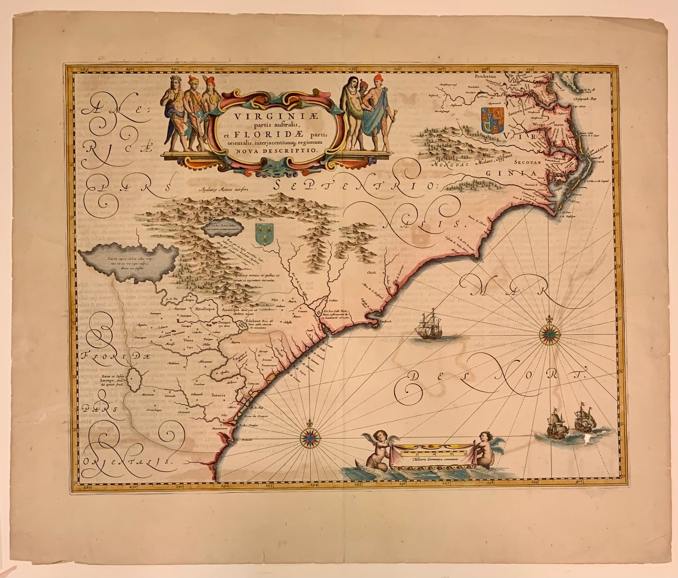
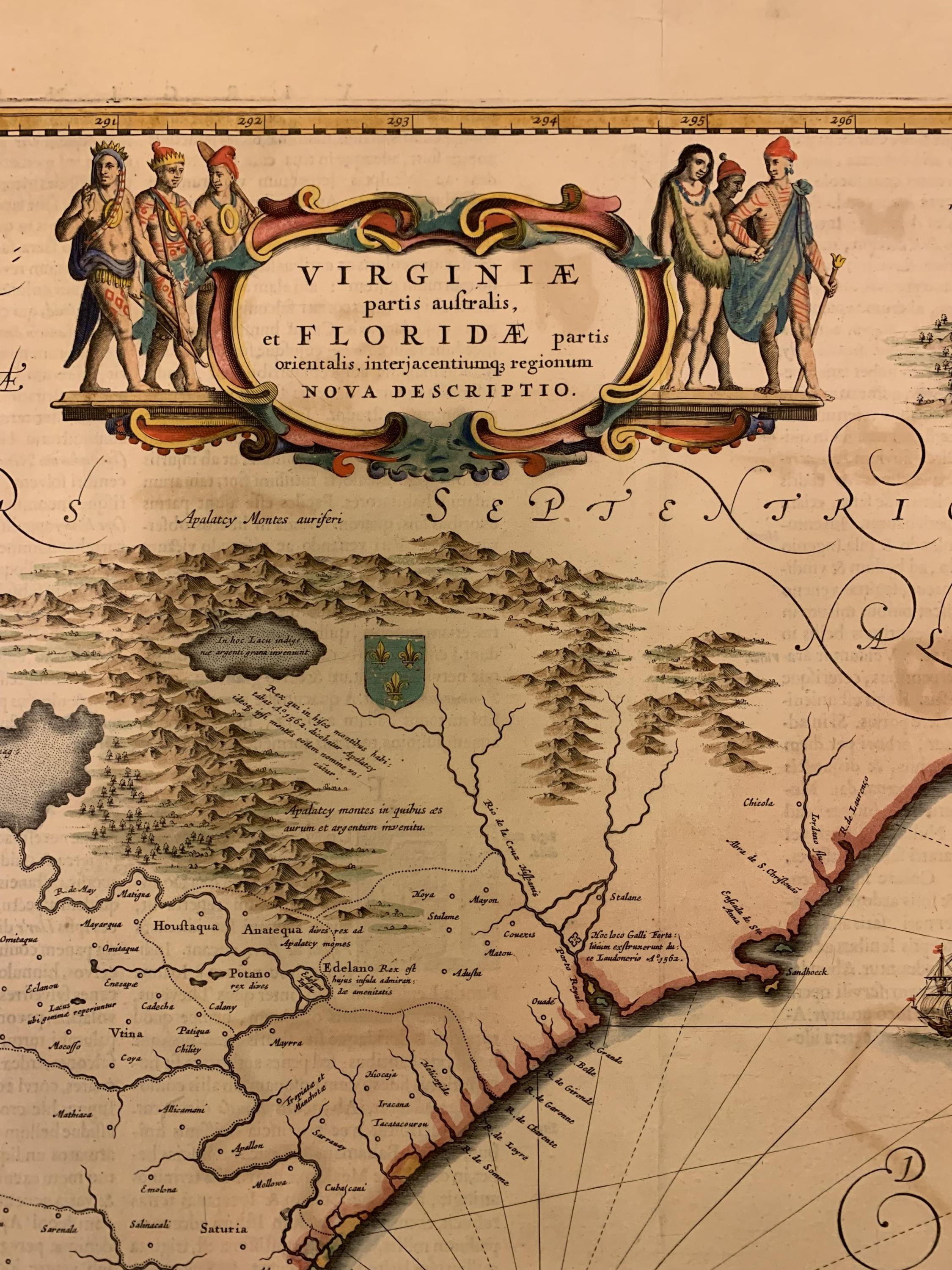
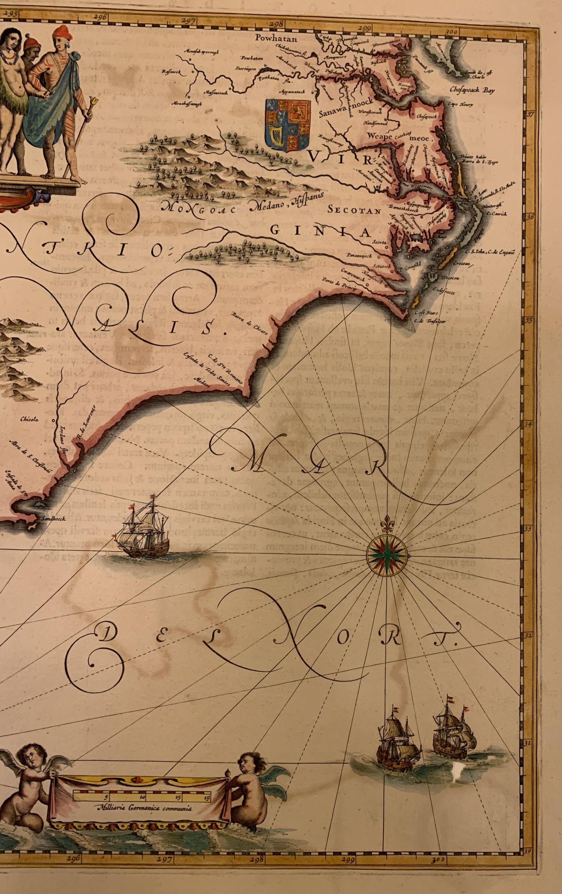
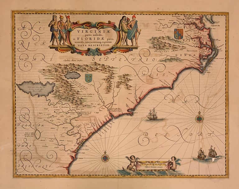
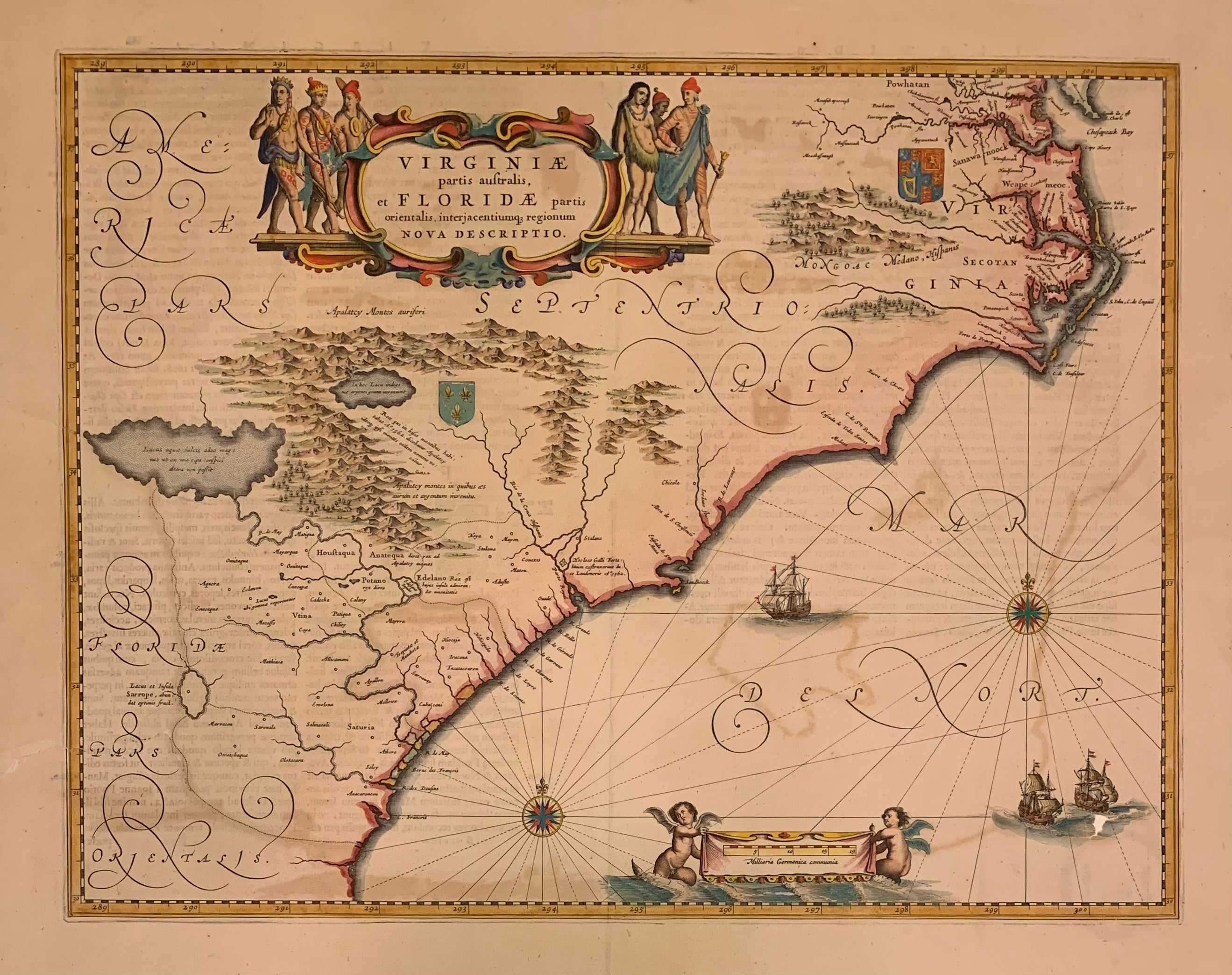
Virginiae Partis australis, et Floridae partis orientalis, interjacentiumq regionum Nova Descriptio
Amsterdam: 1647.
Map. Engraving with original coloring. Image measures 15 1/8 x 19 3/4 inches.
Beautiful early map of the south eastern coast of the United States, from the Chesapeake Bay to northern Florida. The coat of arms of French and English Colonial interests identifying the regional control. Six indigenous people with elaborate tattoos surround the title cartouche. Brittle with repairs with original coloring some loss to waves below ship. Jan Jansson was part of an influential family of map publishers from the Netherlands throughout the 17th century and beyond. They were based in Arnhem then in Amsterdam. They were printers, publishers and booksellers. Major publications were under the joint ownership of the Jansson heirs and their printing empire. A lovely example of this classic map.
Binding: Unbound
Language: English
Price: $1,000.00
Item #309395