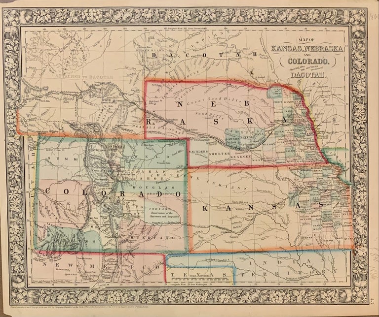
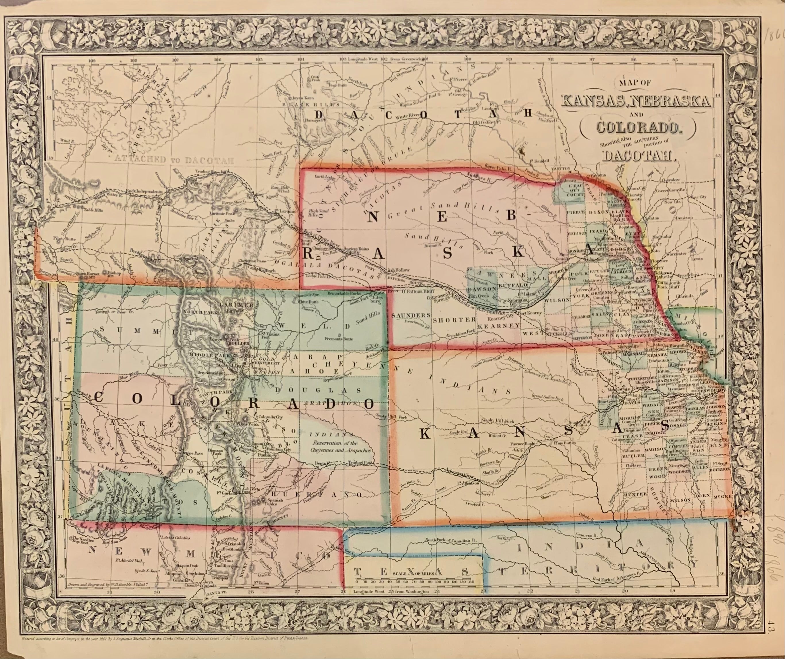
Map of Kansas, Nebraska and Colorado. Showing also the Southern Portion of the Dacotah.; (with attached Dachotah)
Philadelphia: Mitchell, Samuel Augustus Jr., 1866.
Map. Steel engraving with original hand coloring. Image measures 11.5" x 14".
Classic 1866 map of the west, with Kansas, Nebraska, Colorado part of the Dakotas. Counties, major towns and cities, routes, railroads, waterways and Indian tribes and reservations are carefully noted. A few stains and narrow margins but otherwise in good condition.
Samuel Augustus Mitchell Sr. (1792-1868) was one of the leaders in American cartography of the 19th century and pioneered the conversion of engraved map plates to more affordable lithographic plates. His son, Samuel Augustus Mitchell Jr. continued his father's successful mapmaking and publishing business, and was one of the most prolific and renowned 19th century American publishers.
Binding: Unbound
Language: English
Price: $195.00
Item #308737