
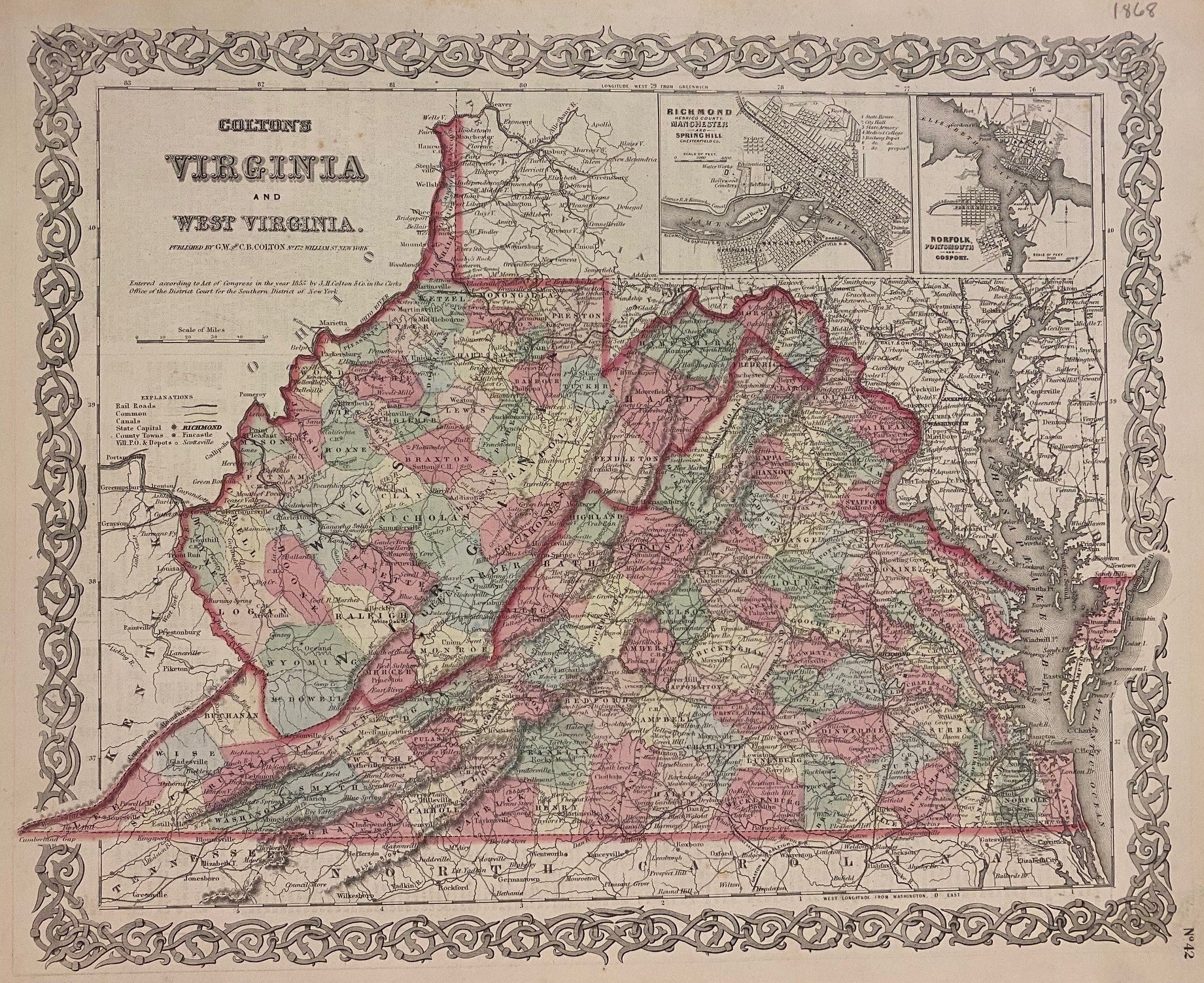
Virginia and West Virginia
New York: J.H. Colton & Co., 1868.
Map. Engraving with original hand coloring. Image measures 13" x 16 1/4"
This map of Virginia and West Virginia shows counties and seats, roads, cities, and railroads. Inset in the upper right corner depict city plans of Richmond (including Manchester and Spring Hill), and Norfolk, Portsmouth, and Gosport along the Elizabeth River. This map is in very good condition, with beautiful hand colored detail. Scattered foxing and some wear to margins, not affecting the image.
The Colton family was one the most prolific and successful publishers of maps and atlases in the United States. J.H. Colton (1800-1893) founded his business in NYC in 1831.
Binding: Unbound
Language: English
Price: $250.00
Item #307827