
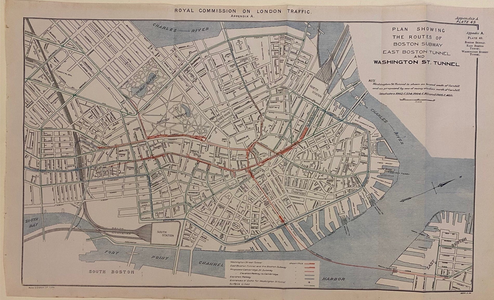
Plan Showing the Routes of the Boston Subway, East Boston Tunnel and Washington St. Tunnel
London: Weller & Graham, 1906.
Map. Lithograph. Measures 13 1/4" x 19 3/4"
Detailed map from the early 20th century highlighting the transportation network of Boston. Published in Volume IV: Appendices to the Report of the Royal Commission on London Traffic, this map appears in Appendix A: The New York Rapid Transit Board and The Subway, by Lynden Macassey, the Secretary to the Royal Commission; Plate 49, Boston Subway, East Boston Tunnel, Washington Street Tunnel.
The map shows subway lines and tunnels, colored to differentiate elevated railways and surface lines. Also includes the proposed Cambridge St. subway and elevated railway to Cambridge. In addition to existing and proposed subway lines, roads and parks are labeled. Folded as issued. Very minimal foxing and spots to margins, not affecting the image.
The Royal Commission on London Traffic was established in 1903 to create a report for the development of a transport system for London and its surrounding areas. The commission's investigation included research visits to many major European and US cities, including New York, Philadelphia, Boston, and Washington DC. The report culminated in eight volumes of research, analyses, and recommendations for improvements and expansion of London's transport network.
Language: English
Price: $250.00
Item #306405