
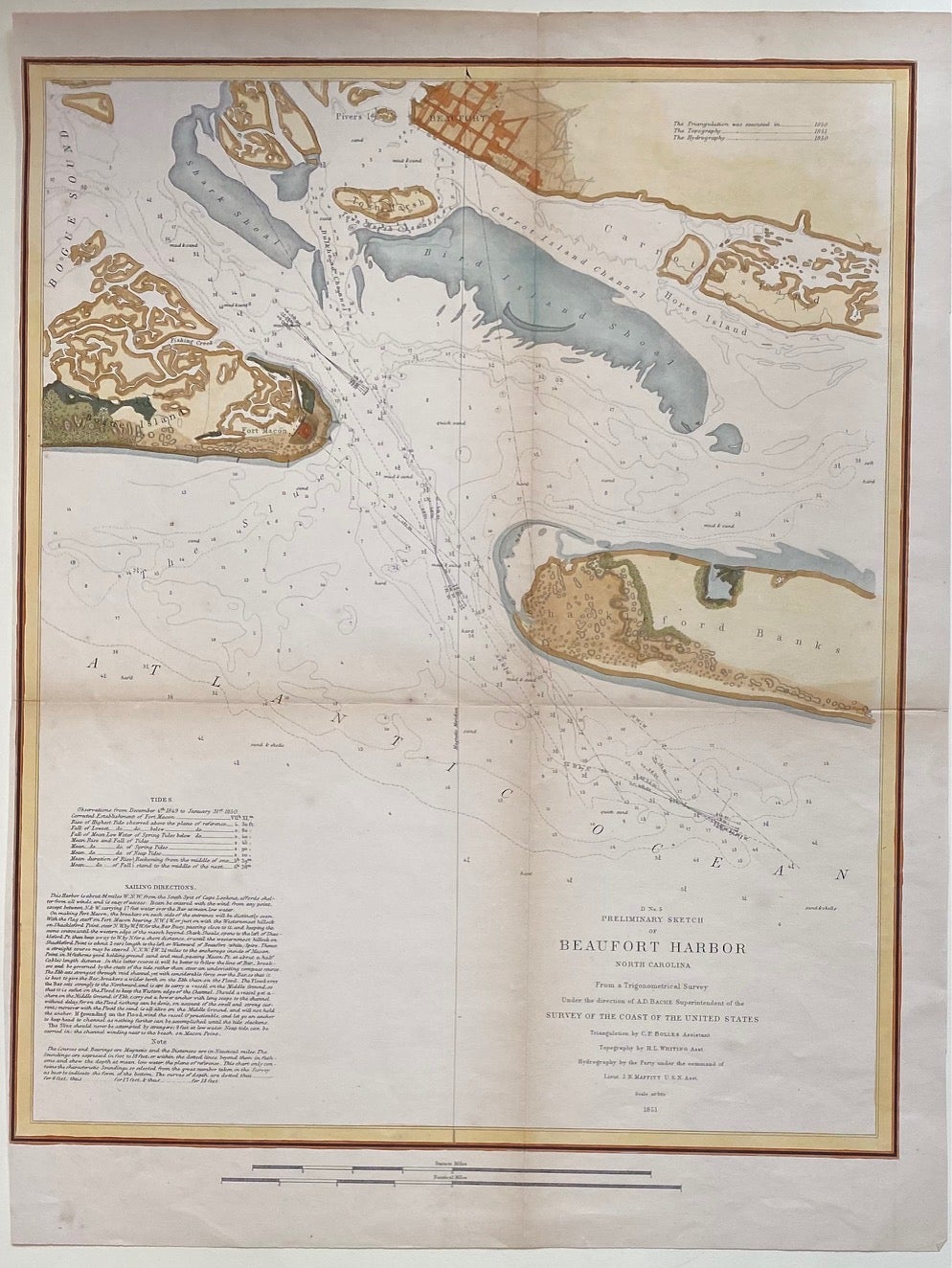
Preliminary Sketch of Beaufort Harbor North Carolina
New York: J. Bien, 1851.
Sea chart. Hand colored lithograph. Image measures 19 1/2" x 14 7/8"
Hand-colored sea chart of Beaufort Harbor in North Carolina. Shows the town of Beaufort, and Shackleford Banks, Bogue Island, and Carrot Island. Includes depths, sandbars, breakers, channels, banks, and creeks. Notes include sailing directions and information on tides and soundings. Minor toning and wear to original center folds.
Alexander Dallas Bache (1806-1867) was an incredibly prolific surveyor, who worked as the superintendent of the United States Coast Survey from 1843 to 1865. Over the course of the 19th century, the survey worked closely with the U.S. Navy to produce sea charts of the country's waters that could serve scientific as well as military functions. This crisp and bright sea chart is a beautiful document of this historical effort.
Binding: Unbound
Language: English
Price: $300.00
Item #303704