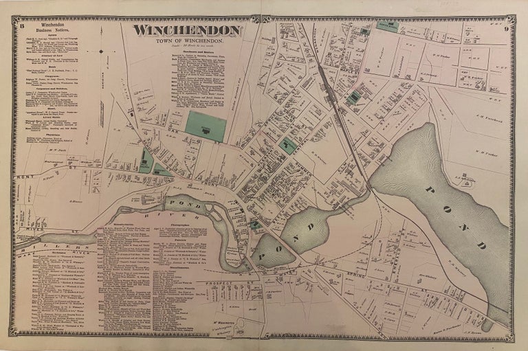
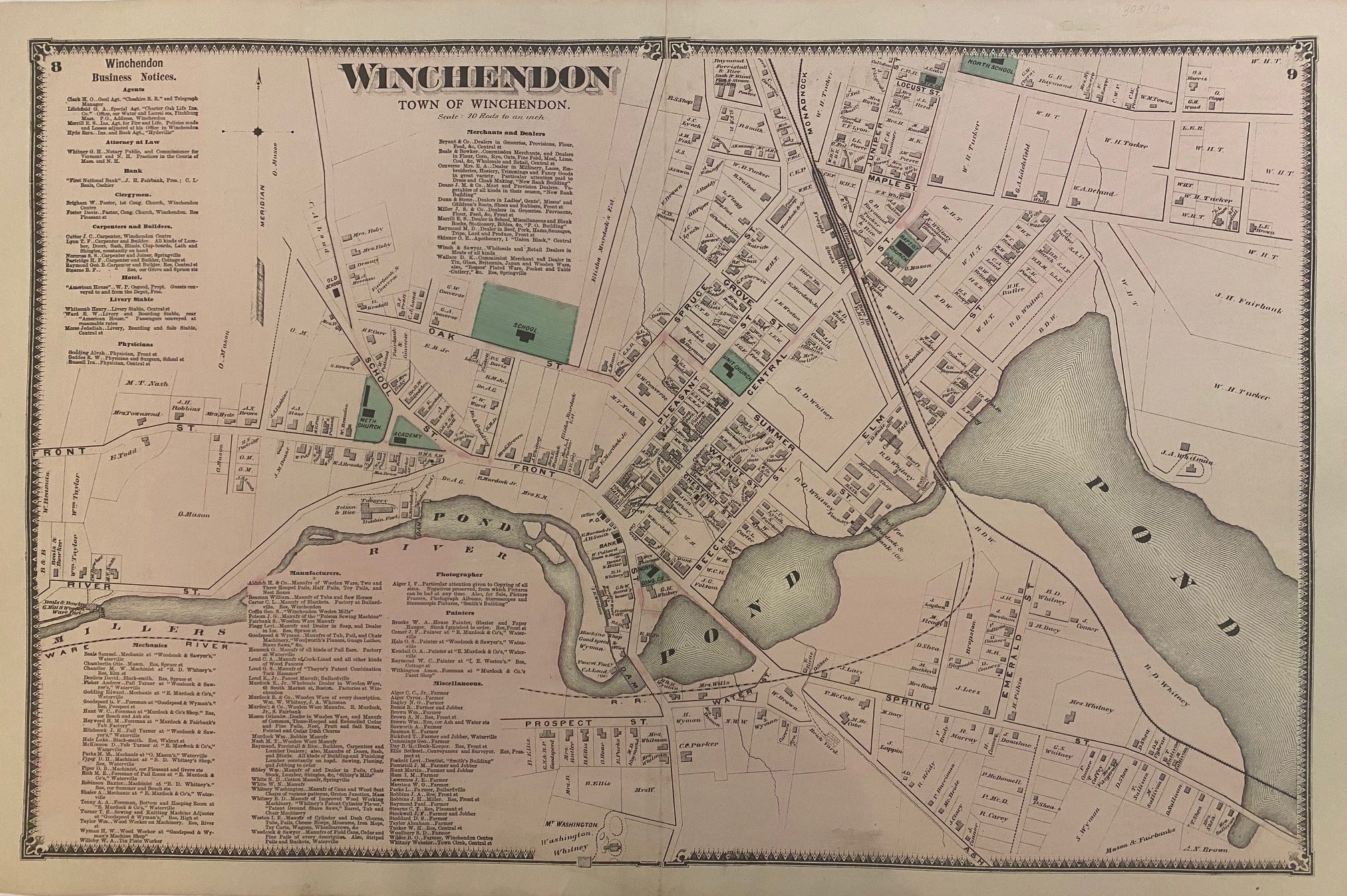
Winchendon
New York: Beers, Comstock, & Cline, 1870.
Map. Engraving with original hand coloring. Image measures 14 1/4" x 22 1/2"
This 1870 map by Frederick W. Beers shows the town of Winchendon, Massachusetts. This map was published in Beers' Atlas of Worcester County, Massachusetts (1870). Includes a business directory.
Frederick W. Beers (flourished 1858-1929) came from a family of surveyors, cartographers and publishers originally from Newtown, Connecticut. F.W. Beers continued the work of his father James Botsford Beers and was known for his county survey maps of New York, Ohio, Pennsylvania, Michigan, Connecticut and Vermont.
Binding: Unbound
Language: English
Price: $150.00
Item #303129