
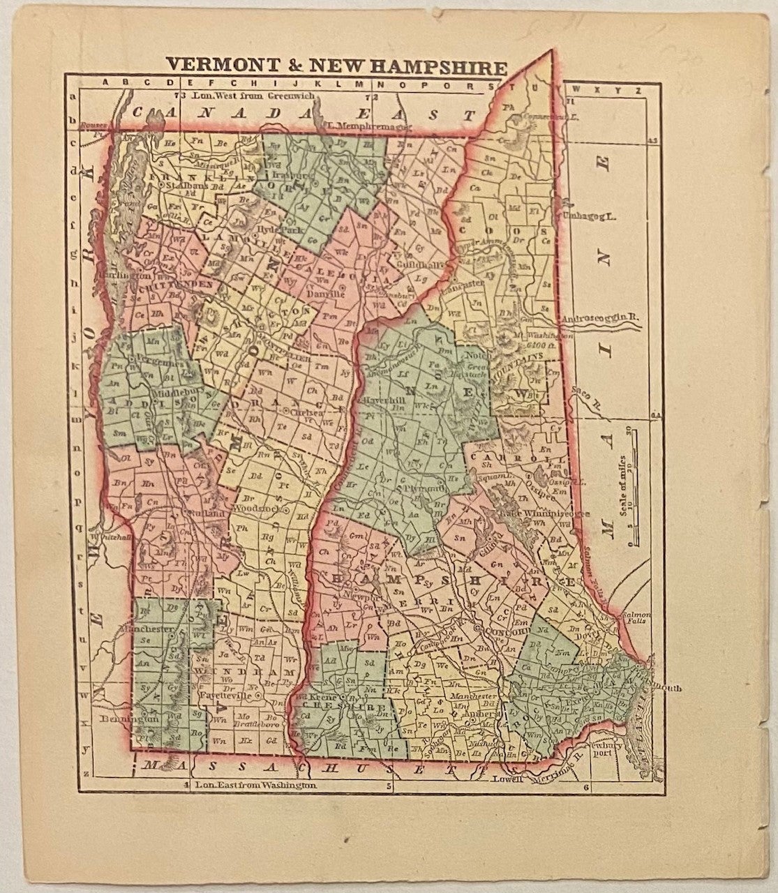
Vermont and New Hampshire
New York: Samuel Gaston, 1857.
Map. Engraving with original hand coloring. Image measures 6 1/4 x 5"
This map shows the states of Vermont and New Hampshire in the middle of the 19th century. Published in 1857, it shows these states during a time of development and industrialization. The states are divided into hand-colored counties, and the index includes towns, rivers, canals, and both existing and proposed railroads. The northernmost tip of New Hampshire peeks out above the top border of the map. The map appeared in Colby's "Diamond Atlas" and is in excellent condition with full margins and no chips or tears. Very slight foxing in left margin not affecting the image. Charles G. Colby (1830--1866) was an American map-maker active in the mid-19th century who is known best for his miniature maps. His "The World in Miniature," otherwise known at the "Diamond Atlas,"focused on the western hemisphere. His main focus was the United States, and he produced individual maps for each of the states. The atlas also includes maps of the hemispheres, several thematic world maps, North America, Canadian provides, the West Indies, and Central and South America. This map is exemplary of Colby's work.
Binding: Unbound
Language: English
Price: $35.00
Item #301303