
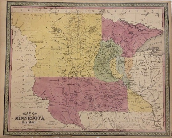
Map of Minnesota Territory
Philadelphia: Thomas, Cowperthwait & Co., 1852.
Map. Engraving with original hand coloring. Image measures 13 1/4" x 16 1/4".
Fascinating map of the Minnesota region, including parts of present day North and South Dakota. Published in 1852, this map depicts the region during a time of rapid change, when settlers were pushing westward and displacing native populations in an effort to establish the territory as a state. Many Native American place names are utilized, and rivers, lakes, topographical features, villages, and forts are labeled. Relief is shown by hachure. A notation in the lower margin references the Chippewa and the Sioux Treaties of 1851. Much of the territory is labeled as Pembina. Minnesota gained statehood in 1858, and tension in the region culminated with the US-Dakota War of 1862. Some chips to margins and toning otherwise in good condition. Thomas Cowperthwait & Co. took over publication of S. A. Mitchell's important "Universal Atlas" in 1850, and continued to produce updated maps that were considered some of the best commercial cartography of the 19th century.
Binding: Unbound
Language: English
Price: $400.00
Item #300111