
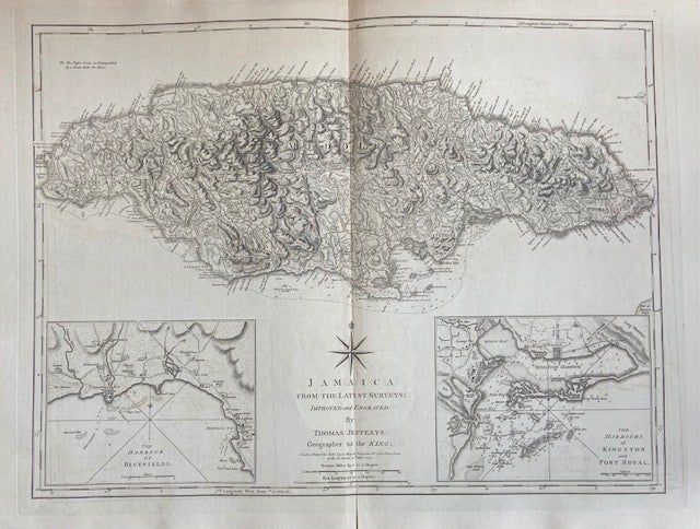
Jamaica; From the Latest Surveys
London: Robert Sayer, 1789.
Map. Engraving. Image measures 18 1/4" x 24 1/4" Some foxing and toning and repairs to center fold, otherwise in good condition.
This scarce map of Jamaica by Thomas Jefferys published in 1789 depicts the Caribbean island in impressive detail. Two insets feature the Harbour of Bluefields and the Harbours of Kingston and Port Royal. Includes depths, settlements, roads, topographical features, salt pans, and reefs. Relief shown by hachures; depths by sounding. Chips and toning to margins.
Thomas Jefferys (1710-1771) was one of the most important and prolific mapmakers of his era with particular focus on North America.
Robert Sayer (1725-1794) was an important English publisher of maps, portraits, and nautical engravings. Partnering with John Bennett around the 1760s, the two published the works of well-known cartographers such as Kitchen, Jefferys, Belling, d'Anville and others. This beautiful, large-scale map is an impressive example of his work.
Binding: Unbound
Language: English
Price: $750.00
Item #299638