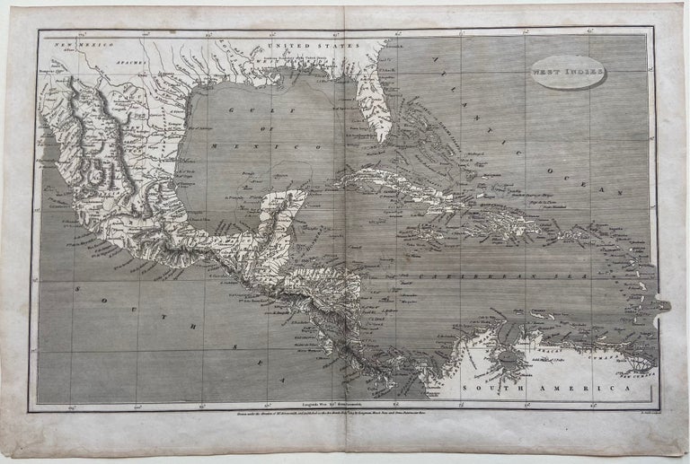
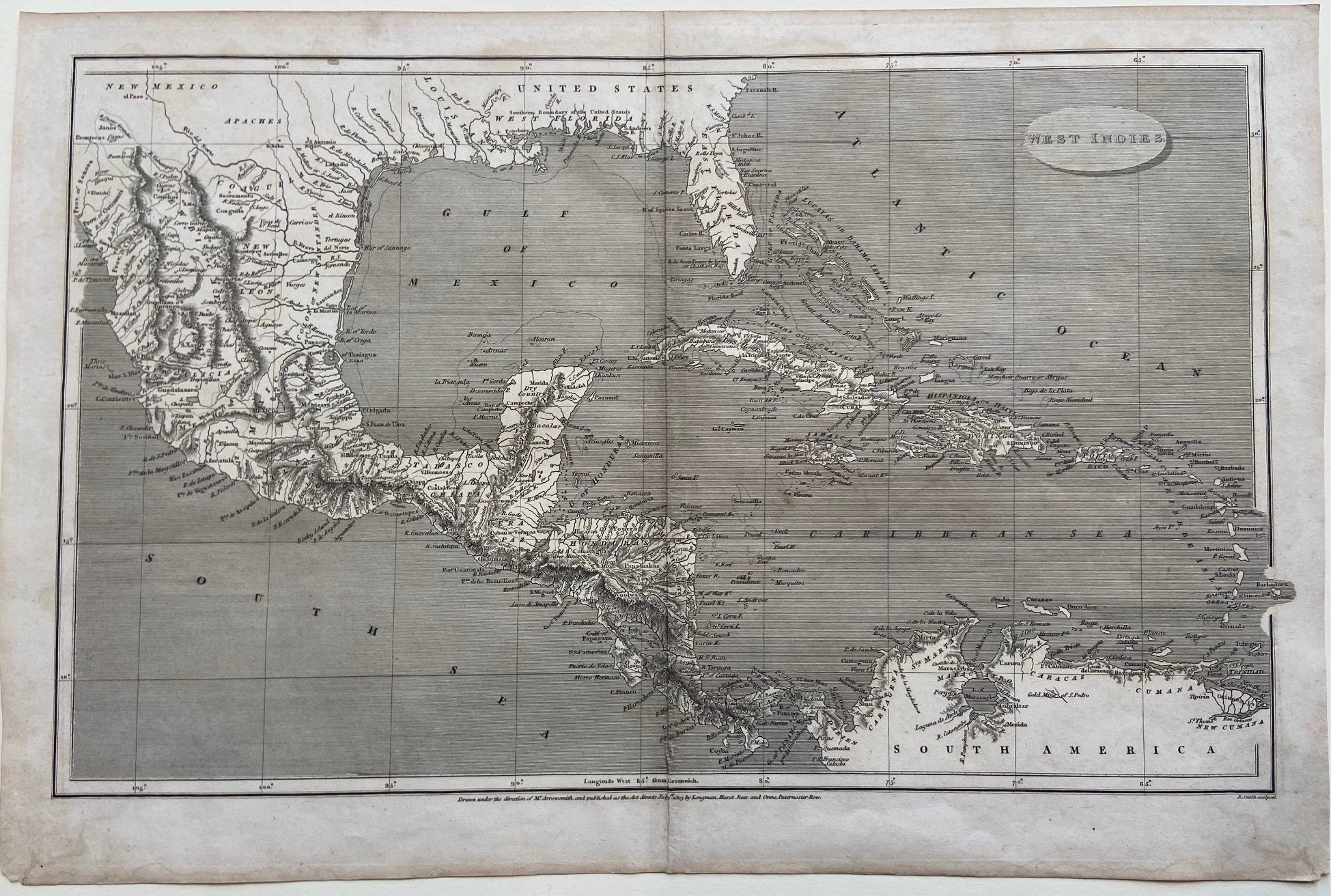
West Indies
London: Longman, Hurst, Rees & Orne.
Map. Original uncolored engraving. Image measures 10" x 16".
This detailed map of the West Indies covers the southern portion of the US extending to the Northern coast of South America. Includes Mexico, Central America, the Gulf of Mexico, the Florida Peninsula, and the Caribbean Sea. Cities, isles, bodies of water, mountain ranges and coastal features are labeled. The map is in good condition. Minimal wear along original folds. Minor stains to lower margin, not affecting image.
Aaron Arrowsmith (1750- 1823) was from a family of London based cartographers and publishers. Trained under John Cary and William Faden, he was given the title of "Hydrographer to the Prince of Wales" in 1810 and "Hydrographer to the King" in 1820. The family business was taken over by his sons, and eventually by his nephew, John Arrowsmith, who was a founding member of the Royal Geographical Society.
Binding: Unbound
Language: English
Price: $250.00
Item #298646