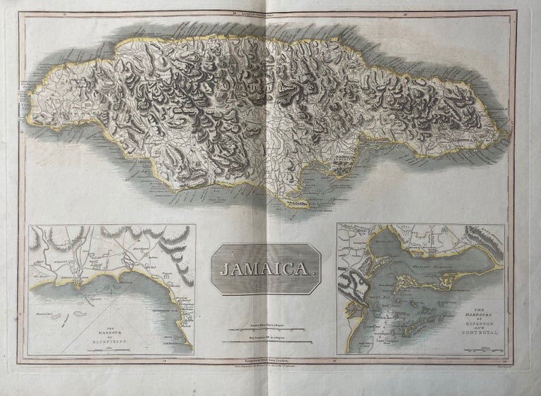
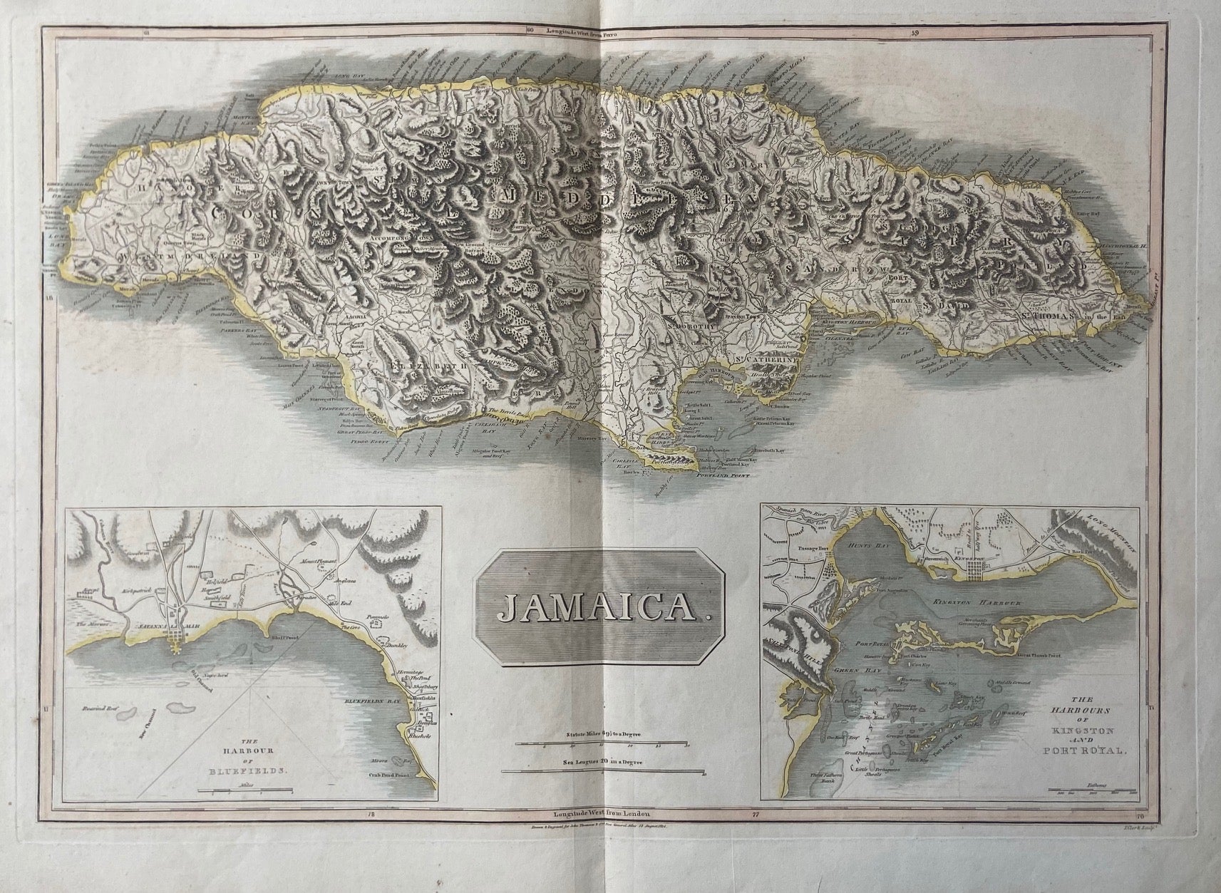
Jamaica
Edinburgh: John Thomson, 1814.
Map. Engraving with original hand coloring. Image measures 17" x 24"
This map of the Jamaica depicts the island in impressive detail, showing roads, cities, towns, ports, and topographical details. Two insets show the Harbors of Bluefields, and of Kingston and Port Royal, including settlements, reefs and kays, and roadways.
The map is in good condition with minor wear along the original centerfold and plate mark visible. Minor spotting at places.
John Thomson (1777 - 1837) was a Scottish bookseller and publisher active in the early 19th century, who was one of the leaders in Europe who favored detailed and accurate mapping over the decorative and elaborate cartouches that appeared in earlier maps. His most important work was "Thomson's New General Atlas" and his "Atlas of Scotland". Although he went into bankruptcy twice during his career, his maps are today highly desirable for their scale and detail. This is beautiful example of his work.
Binding: Unbound
Language: English
Price: $300.00
Item #298159