
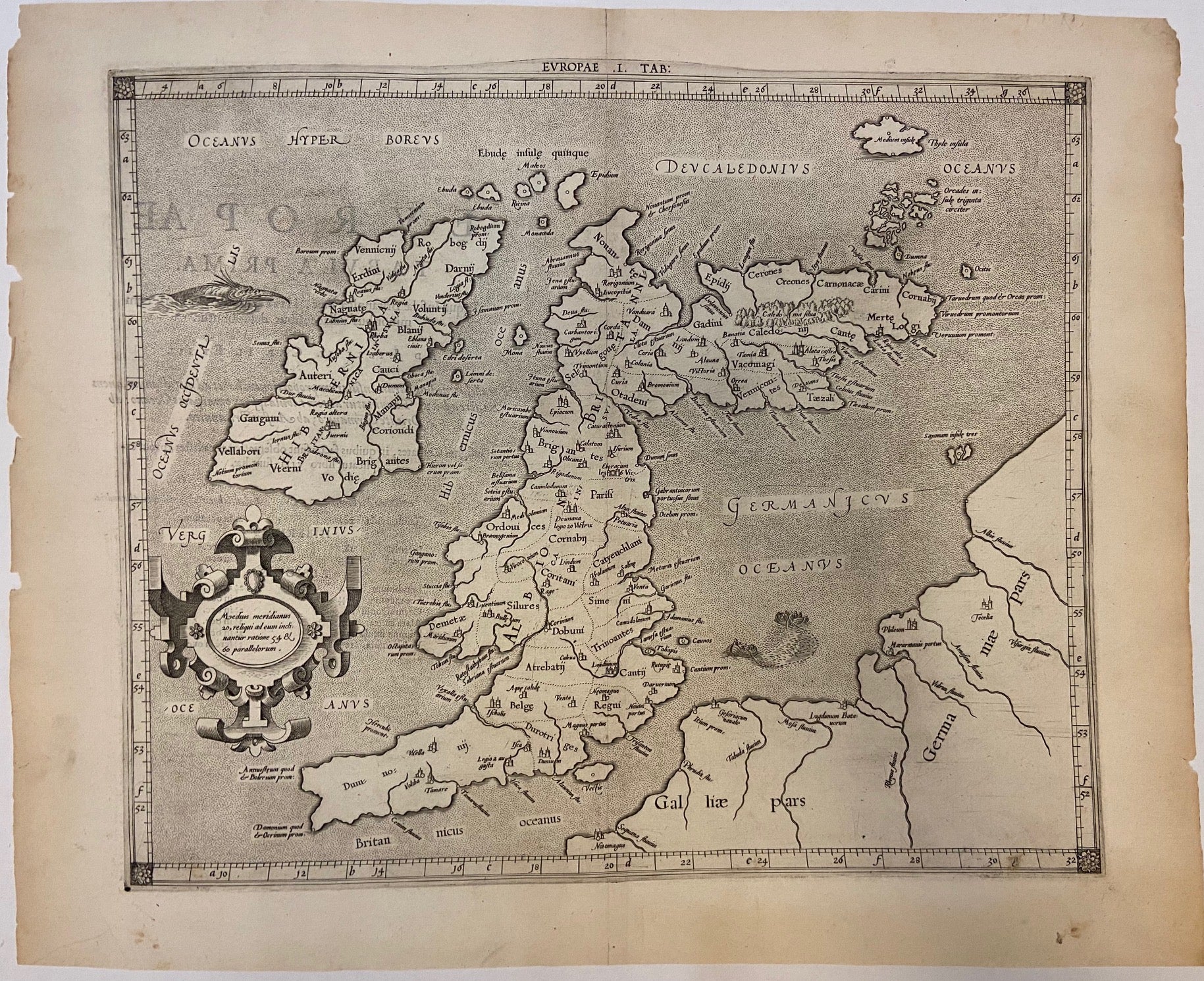
Europae I. Tab:
Cologne: Petrus Bertius, 1618.
Map. Engraving with hand coloring. Sheet measures 19 5/8" x 15 3/4".
This ancient map of the British Isles issued by Gerard Mercator was first published in the 1584 edition of Tablae Geographicae. This Ptolemaic map includes the present-day United Kingdom, Ireland, and shows parts of France and Germany. The map includes an ornate title cartouche and a sea monster that appears to be a cross between a bird and a fish. Important towns and cities, are labeled with names and symbols. Islands and rivers are also labeled. A expanse of forest in Scotland is depicted pictorially, and an illustration of a fishing operation is seen off the coast of France and Germany. In good condition with minor wear and toning to margins, image unaffected.
Gerard Mercator (1512-1594) was an accomplished mathematician, cartographer, globe maker and engraver but is best known for the Mercator Projection. Incorporating the newly accepted fact that the world is round, Mercator was able to render longitude lines consistently straight on a chart. Although this requires some distortion, it was of great use for navigators, and is historically important, as it is still the most commonly used projection today. Petrus Bertius (1575-1629) was a Flemish cosmographer who worked for Louis XIII in Paris.
Binding: Unbound
Language: latin
Price: $850.00
Item #296727