![Item #294031 Part of Section 1 [Lower East Side, East River, Manhattan Bridge, Corlears Hook Park]. George W. BROMLEY, Walter S. BROMLEY.](https://argosybooks.cdn.bibliopolis.com/pictures/294031.jpg?width=768&height=1000&fit=bounds&auto=webp&v=1576187531)
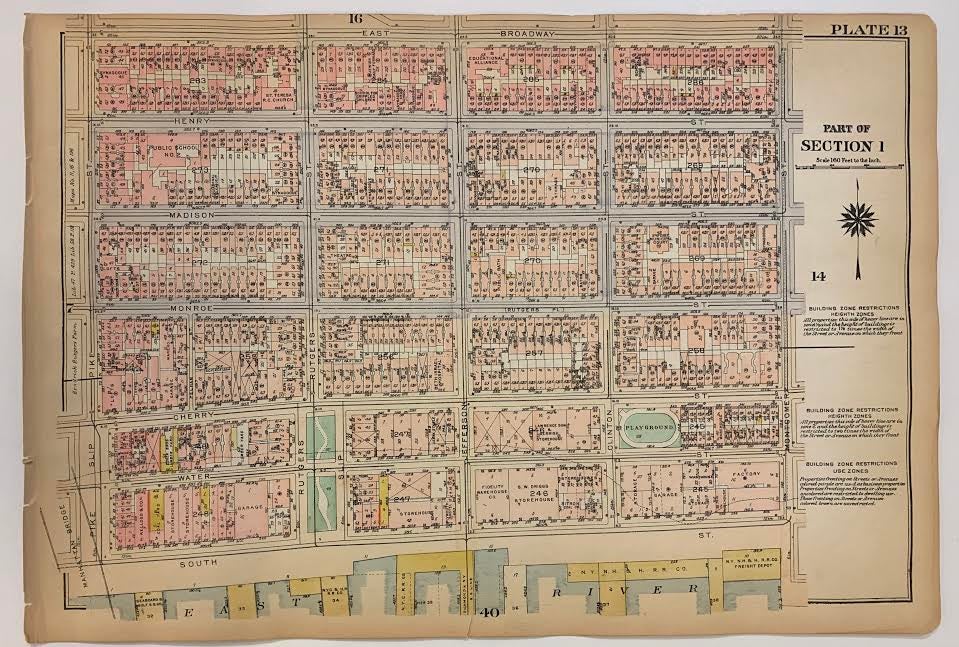
Part of Section 1 [Lower East Side, East River, Manhattan Bridge, Corlears Hook Park]
Philadelphia: G.W. Bromley, 1925.
Map. Original Lithograph. 11.5 x 16.5 inches
This ward map of Manhattan shows on the recto the area between East Broadway and the East River, from Manhattan Bridge and Pike Slip to Montgomery St. On the verso, it depicts from the East River at Corlears Hook Park to Grand St., East Broadway, and Montgomery St. Ward maps were used by fire insurance companies to determine the potential hazards of particular buildings. Color-coding indicates building materials: pink denotes brick and yellow denotes wood. The map was published in Bromley's 1925 Desk top edition of "Atlas of the City of New York, Borough of Manhattan". It is in very good condition with pleasant original coloring. This fine map shows how much New York City has changed--and hasn't--in the last hundred years.
Language: English
Price: $125.00
Item #294031