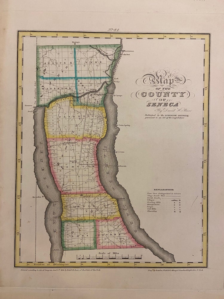
Map of the County of Seneca
New York: David H. Burr, 1829.
Map. Copper plate engraving with original hand-coloring. Image measures 11 3/4 x 14 1/2 inches.
This map depicts Seneca County in eastern New York, divided into 9 towns outlined in vivid color. Seneca Falls is named as is the Cayuga%u2013Seneca Canal. The map denotes major routes, waterways, and topographical details, and icons label villages, flouring mills, factories, forges, saw mills, and churches. This first edition of Burr's county map appeared in his "Atlas of the State of New York" of the same year, which was the second atlas of an individual state ever published.
The map is in good condition with light foxing throughout. Full original margins.
David H. Burr (1803-1875) served as Topographer to the United States Post Office and Geographer to the House of Representatives and was widely known for his accuracy and attention to detail. His "Universal Atlas" was the first to map each of the United States individually. This map is a lovely rendering of a hard-to-find county in New York State.
Illustrator: Rawdon Clark & Co.
Binding: Unbound
Language: English
Price: $250.00
Item #293671