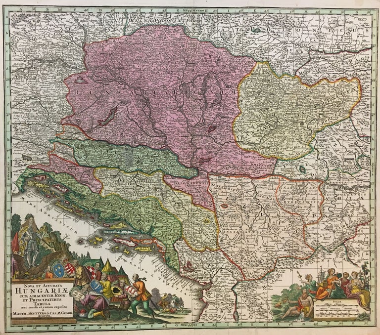
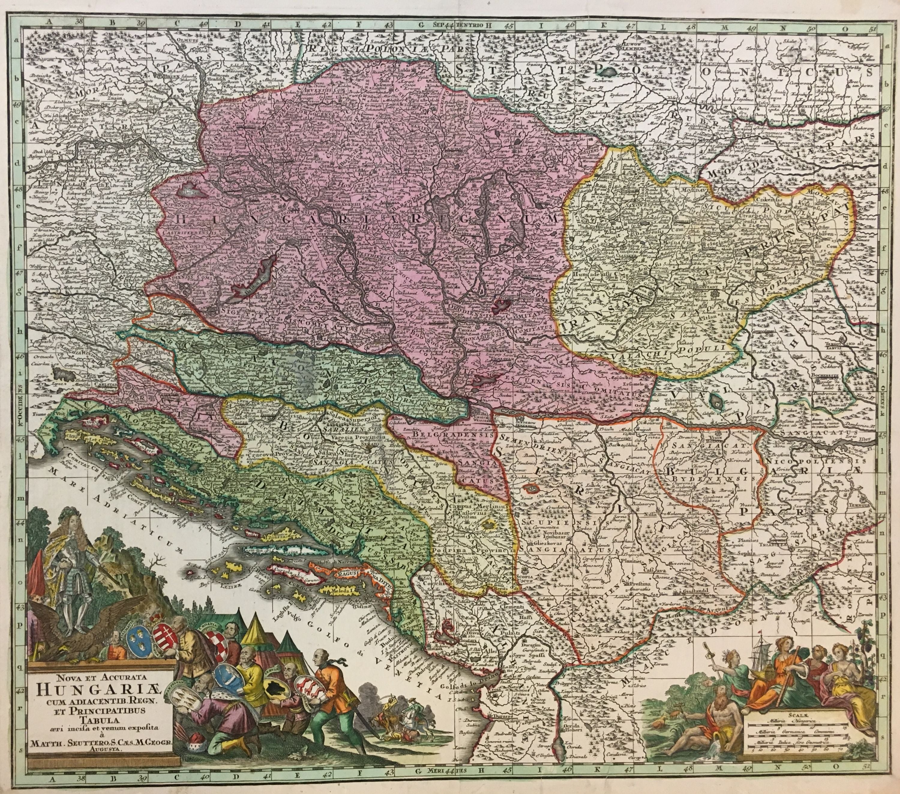
Nova et Accurata Hungariae Cum Adiacentib. Regn. et Principatibus Tabula
Augsburg.
Map. Hand colored engraving. 19 3/4" x 22 3/4".
Fine antique map of Hungary and surrounding areas shown in just one configuration of the many possible snapshots of the 18th century border changes in the region. Depicted around 20 years following the second Battle of Mohacs which, through the end of the 17th century led to Transylvania becoming a part of Hungary again. By 1718, only a few years prior to this map, the entire Kingdom of Hungary had become removed from Ottoman rule. It was, however, still a part of the Habsburg Empire. The Balkans had also been relinquished to the Habsburg Empire by the Ottomans. An ornamental cartouche shows what is presumed to be a Hapsburg Ruler, either Joseph I, or Charles VI standing on an eagle. Bowing down to him are men holding the coats of arms of Dalmatia, Hungary, Croatia, Bosnia, Serbia, Transylvania, and Sclavonia, signifying their allegiance to the Habsburg Empire at this time. The map labels the larger country regions as well as counties within each country. Traditional topographical features such as mountains, forests, bodies of water, and castles are marked as well. Light abrasion in Sclavonia, otherwise in great condition. Matthaus Seutter the elder (1678-1757) was an engraver, globe maker and map publisher based in Augsburg. He apprenticed with J.B. Homann in Nuremberg and was awarded the title of Imperial Geographer by Karl VI in 1731. His son-in-law T.C. Lotter took over the business in 1758. This is a wonderful example of his work.
Language: Latin
Price: $750.00
Item #291956