
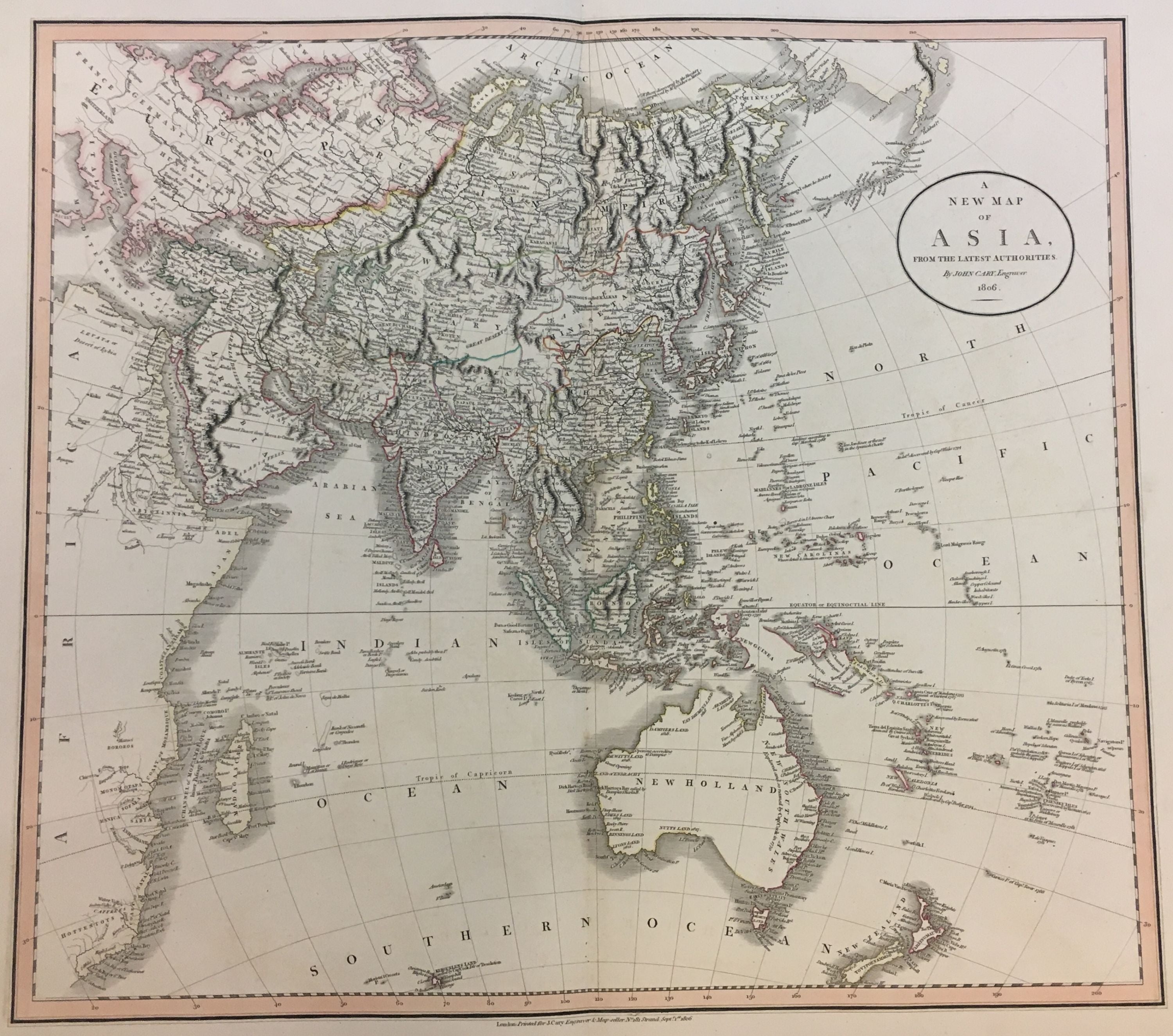
A New Map of Asia From the Latest Authorities
London: G. & J. Cary, 1806.
Map. Engraving with original hand coloring. Image measures 18" x 20.5".
This stunning early 19th century map of Asia by Cary depicts the continent, showing from Europe to Japan, and as far south as New Zealand. Identifies the Great Wall of China. The disputed waters between Korea and Japan are here unlabeled. Important cities, rivers, towns, mountains, deserts, islands and other topographical features are noted throughout.
Focusing on the political divisions at the time, the map gives a beautiful snapshot of the region at a time when Imperial China's Qing Dynasty was suffering from uprising and rebellion and the Russo-Turkish Wars were beginning. The British were beginning to obtain complete control over India.
John Cary (1754-1835) was a British cartographer and engraver. His highly detailed and accurate maps mark a turning point from the earlier emphasis on decoration toward a greater emphasis on information. This map is a fine example of Cary's work.
Binding: Unbound
Language: English
Price: $475.00
Item #291531