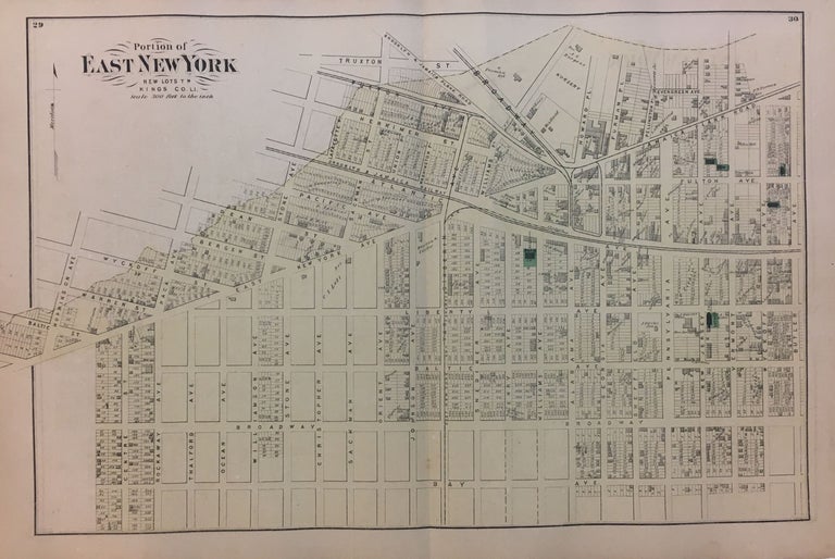
Portion of East New York New Lots, Kings Co. L.I.; Early Beers map of Bushwick Brooklyn!
New York: Beers, Comstock, & Cline, 1873.
Map. Lithograph with original hand coloring. Sheet measures 15.5" x 23.5". Shows some small tears at edges, image unaffected. In very good condition.
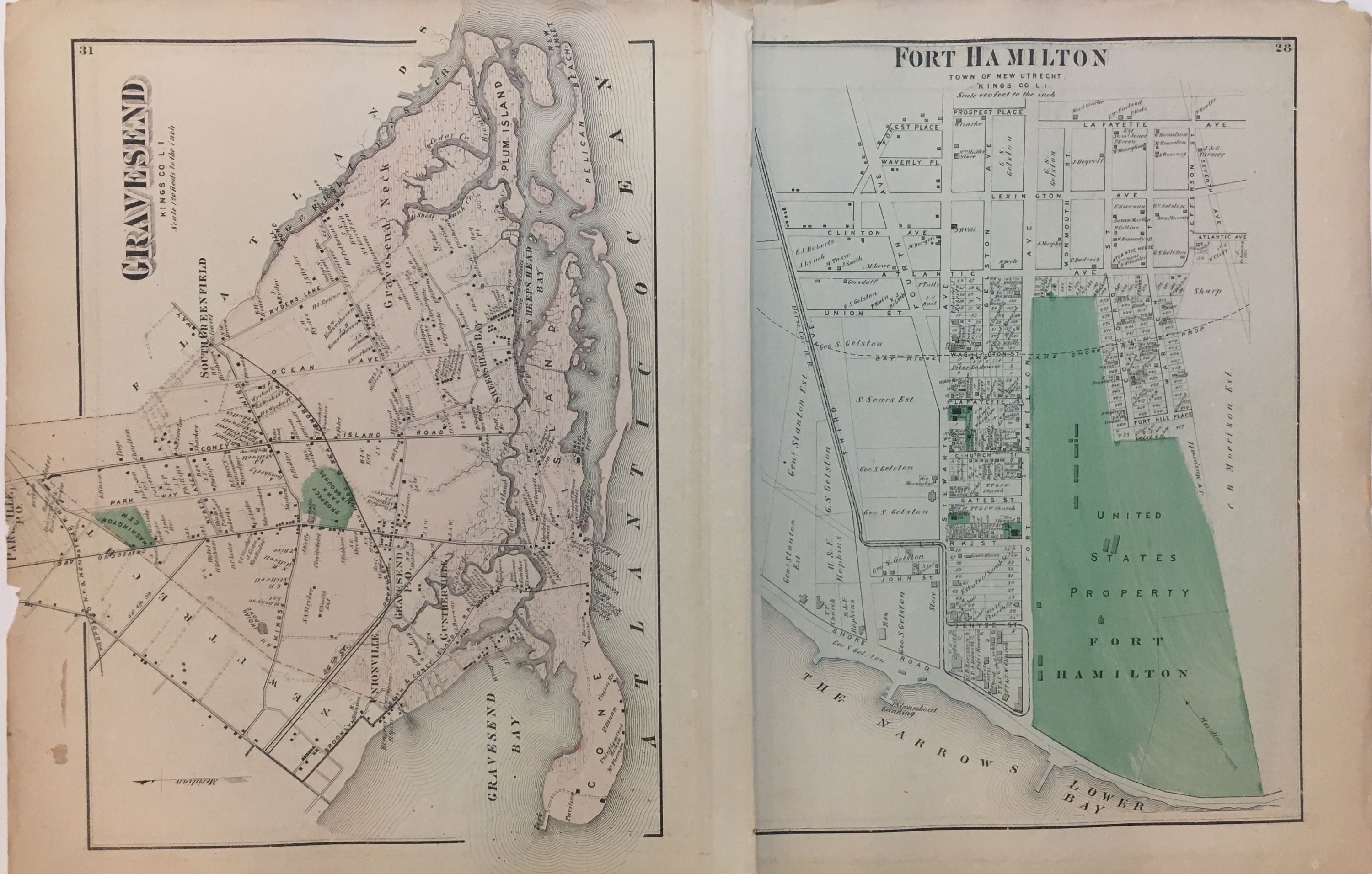
This 1873 map by Frederick W. Beers shows the East New York neighborhood of Brooklyn, at the convergence of Brownsville, East New York and Cypress Hills. Verso shows details of Gravesend and Fort Hamilton. Included in Beers' Atlas of Long Island, New York (New York: Beers, Comstock, & Cline, 1873).
Frederick W. Beers (flourished 1858-1929) came from a family of surveyors, cartographers and publishers originally from Newtown Connecticut. F.W. Beers continued the work of his father James Botsford Beers and was known for his county survey maps of New York, Ohio, Pennsylvania, Michigan, Connecticut and Vermont.
Binding: Unbound
Condition: Very Good
Language: English
Price: $250.00
Item #289167