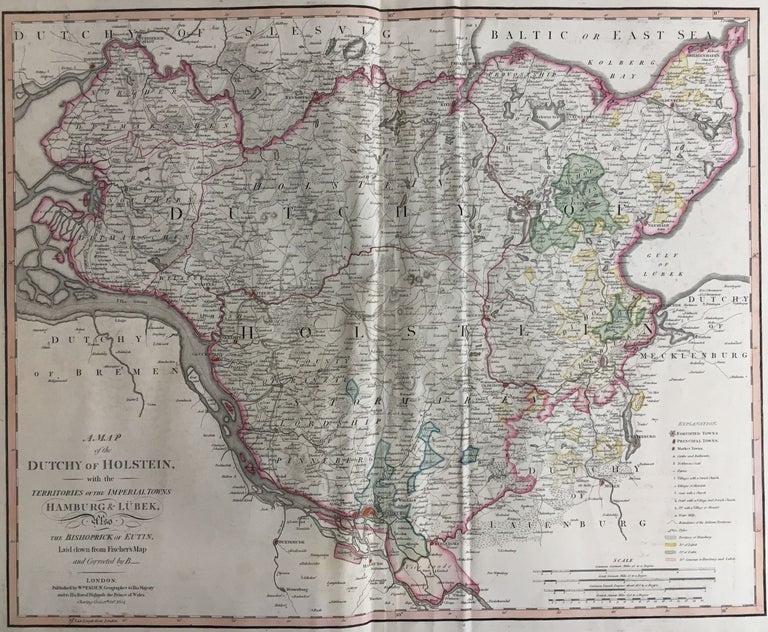
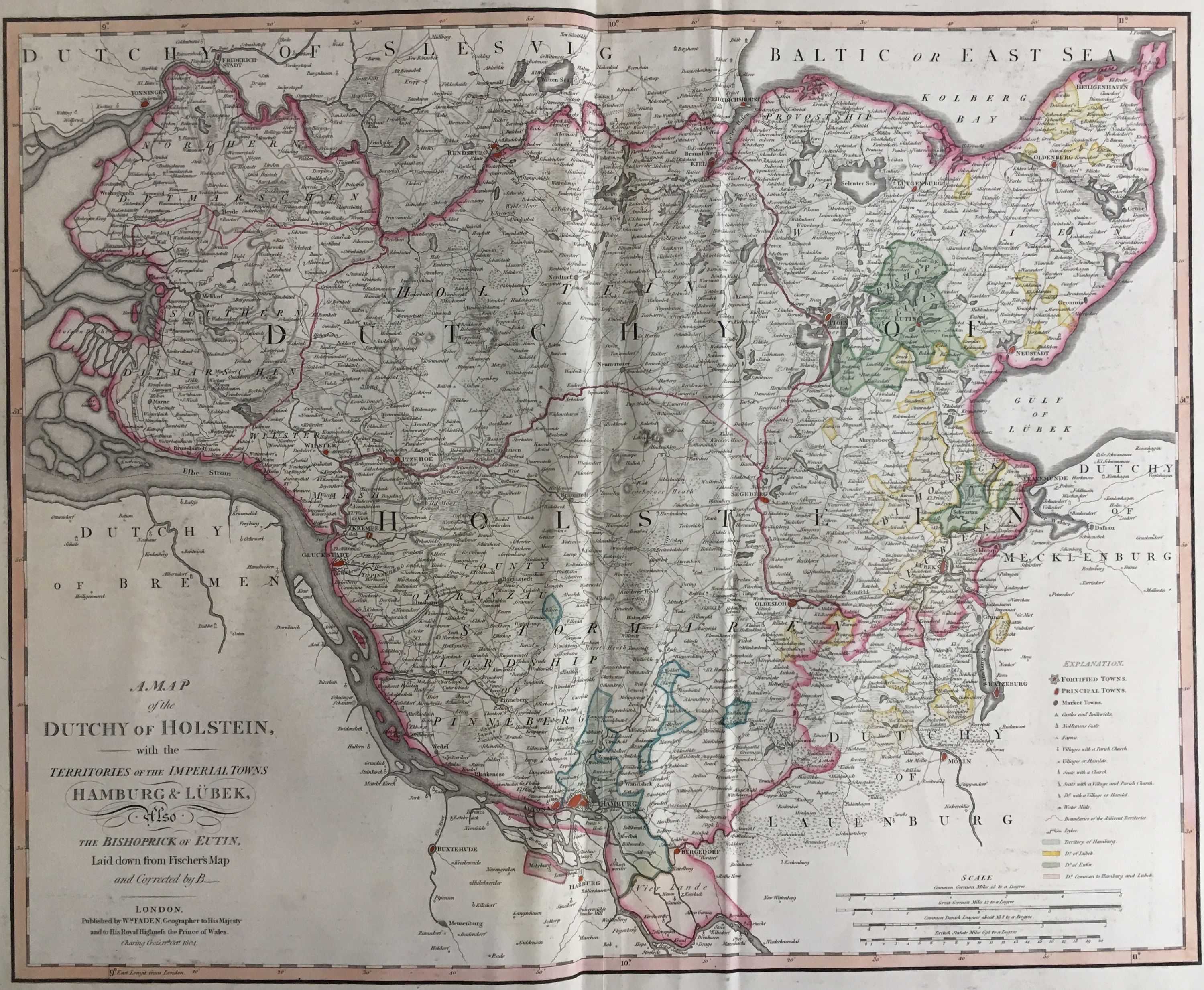
A Map of the Dutchy of Holstein, and the Territories of the Imperial Towns Hamburg & Lubeck, Also the Bishoprick of Eutin
London: William Faden, 1804.
Map. Engraving with hand coloring. 23" x 31".
This scarce map of the disputed territory of the Duchy of Holstein in 1804 when it still belonged to Denmark. The chart notes fortified towns, market towns, castles, and other important notations which are visibly marked with a detailed key. Original hand colour. Important cities of Hamburg, Lubeck, and Eutin are identified. In 1848, there was an uprising in the Duchies of Schleswig (directly north of Holstein), and Holstein after a call to integrate the two duchies better into the Kingdom of Denmark. The large German majority supported independence and a closer association with the German Confederation, leading to the First, and subsequently Second Schleswig War, the latter of which ended in the Danish cession of Schleswig and Holstein to Prussia and Austria. William Faden (1750-1836) was an 18th century English cartographer, engraver, mapseller, and publisher as well as 'Geographer to His Majesty & to his H.R.H. the Prince of Wales, George III & George IV. This is a beautiful example of his work.
Language: English
Price: $500.00
Item #288458