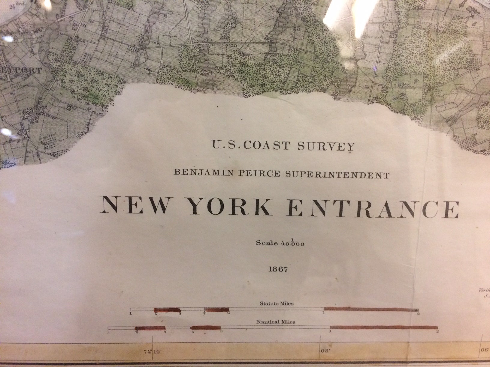
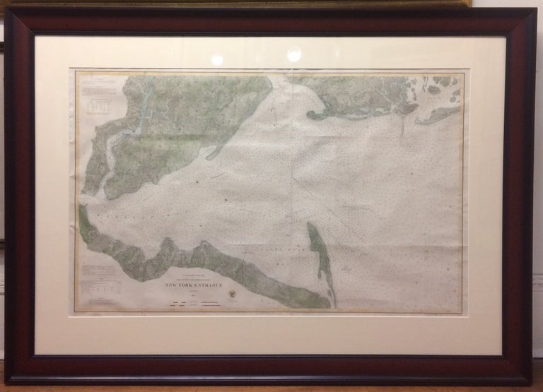
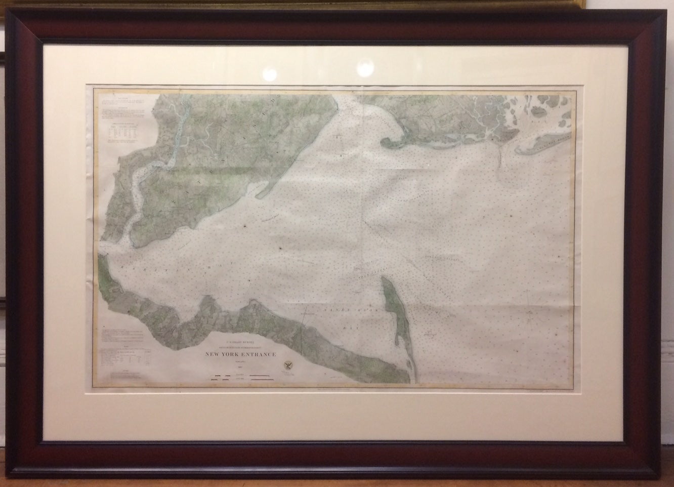
New York Entrance
U.S. Coast Survey, 1867.
Map. Lithograph with hand coloring. Image measures 24 x 39 inches. In beautiful wide cherry wood frame measures 37 x 51 x 1.5 inches. Repair top left margin. In very good condition.
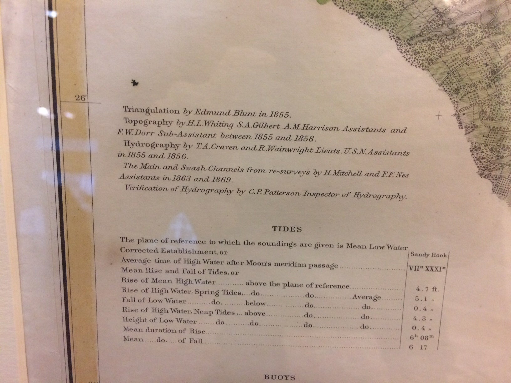
Large sea chart published by the U.S. Coastal Survey under Benjamin Pierce. Shows the entrance to New York harbor, shipping channels, Staten Island, Perth Amboy, Coney Island, Gravesend, Sandy Hook Bay, and the Rockaways. Over the course of the 19th century, the U.S. Coast Survey survey worked closely with the U.S. Navy to produce sea charts of the country's waters that could serve scientific as well as military functions.
Benjamin Pierce, a mathematician and astronomer, was the third Superintendent of the Coastal Survey.
Binding: Framed
Language: English
Price: $850.00
Item #287887