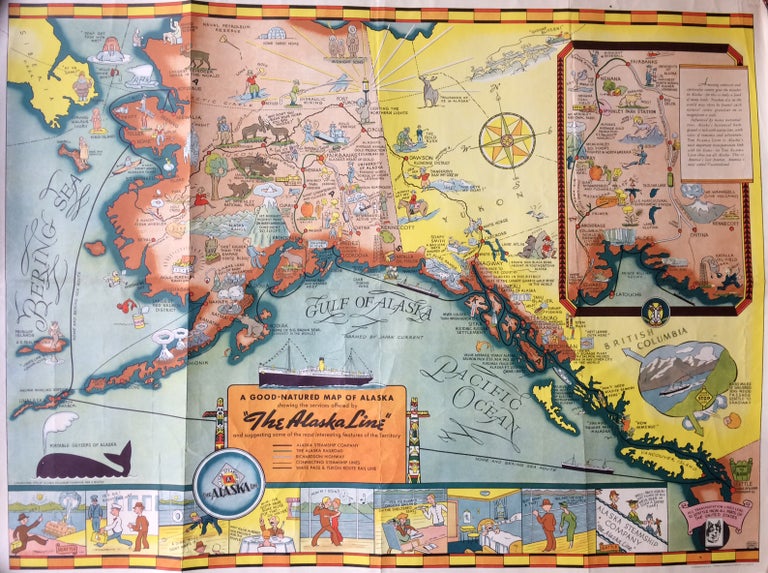
A Good Natured Map of Alaska showing the services offered by "The Alaska Line" and suggesting some of the most interesting features of the Territory
Seattle: Farwest Lithograph and Printing Co., 1939.
Map. Color Lithograph. 21" x 28".
This beautifully colored map of Alaska and the Gulf of Alaska shows the Alaskan boat lines from Seattle and was first drawn by Edward Camy for the Alaska Steamship Company in 1934. A great pictographic map, includes an inset showing the Alaska Railways route from Seward to Fairbanks and the Richardson Automobile Highway. The bottom of the map shows a series of cartoons of events on the ship. In good condition, a great example of Alaska.
Language: English
Price: $500.00
Item #286138
See all items by Alaska Steamship Company