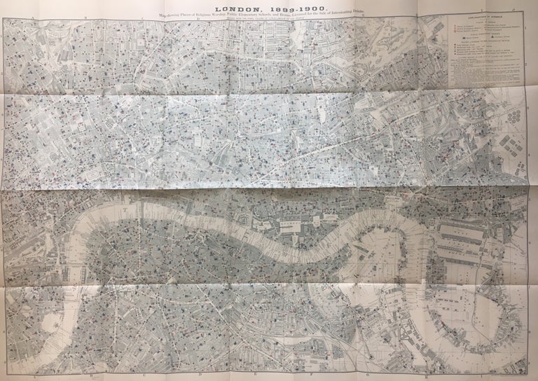
London, 1899-1900; Map showing Places of Religious Worship, Public Elementary Schools, and Houses Licensed for the Sale of Intoxicating Drinks
London: Stanford's Geographical Establishment, 1902.
Map. Color lithograph. Image size 26" x 36 3/4", page size 27" x 40 1/4".
Iconic map which was included in the final series of three of Charles Booth's "Life and Labour of the People of London." The last series was a conclusion of the previous two. This particular map was intended to highlight the hierarchy of social influences in London, showing an overwhelming number of houses that sell alcohol as compared to schools and places of religious worship. Folded as issued with some folds reinforced with Japanese tissue. Otherwise in very good condition. Stanford's Geographical Establishment was founded in 1853. Publishers of maps and globes, the company still flourishes today. Charles Booth was an English social researcher and reformer. His claim to fame is his sociological analysis of London at the turn of the 19th century, most notably his "Poverty Map." Mode collection 1138.05
Condition: Very Good
Language: English
Price: $1,850.00
Item #284333