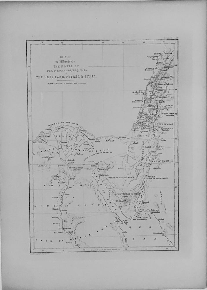
Map to Illustrate The Route of David Roberts
London: Day & Son, 1856.
Map. Engraving. Sheet measures 11" x 7 3/4".
From Roberts's octavo edition of "Views in the Holy Land...Egypt and Nubia," this map depicts the Nile in Egypt up to Damascus and Tripolis, and as far south as the Red Sea and Upper Egypt. Born in Scotland, Roberts (1796-1864) gained renown as a landscape artist from documenting his extensive travels through Spain and the Near and Middle East. His most well known work, "Views in the Holy Land...Egypt and Nubia" illustrates Roberts' trip in 1838-39. The subsequent publication was issued in 41 parts between 1842 and 1849. This magnificent set was a collaborative project between Roberts and the skilled printer Louis Haghe (1806-1885) and is recognized as one of the most important lithographic works of the 19th century.
Illustrator: HAGHE, Louis
Binding: Unbound
Language: English
Price: $75.00
Item #283461