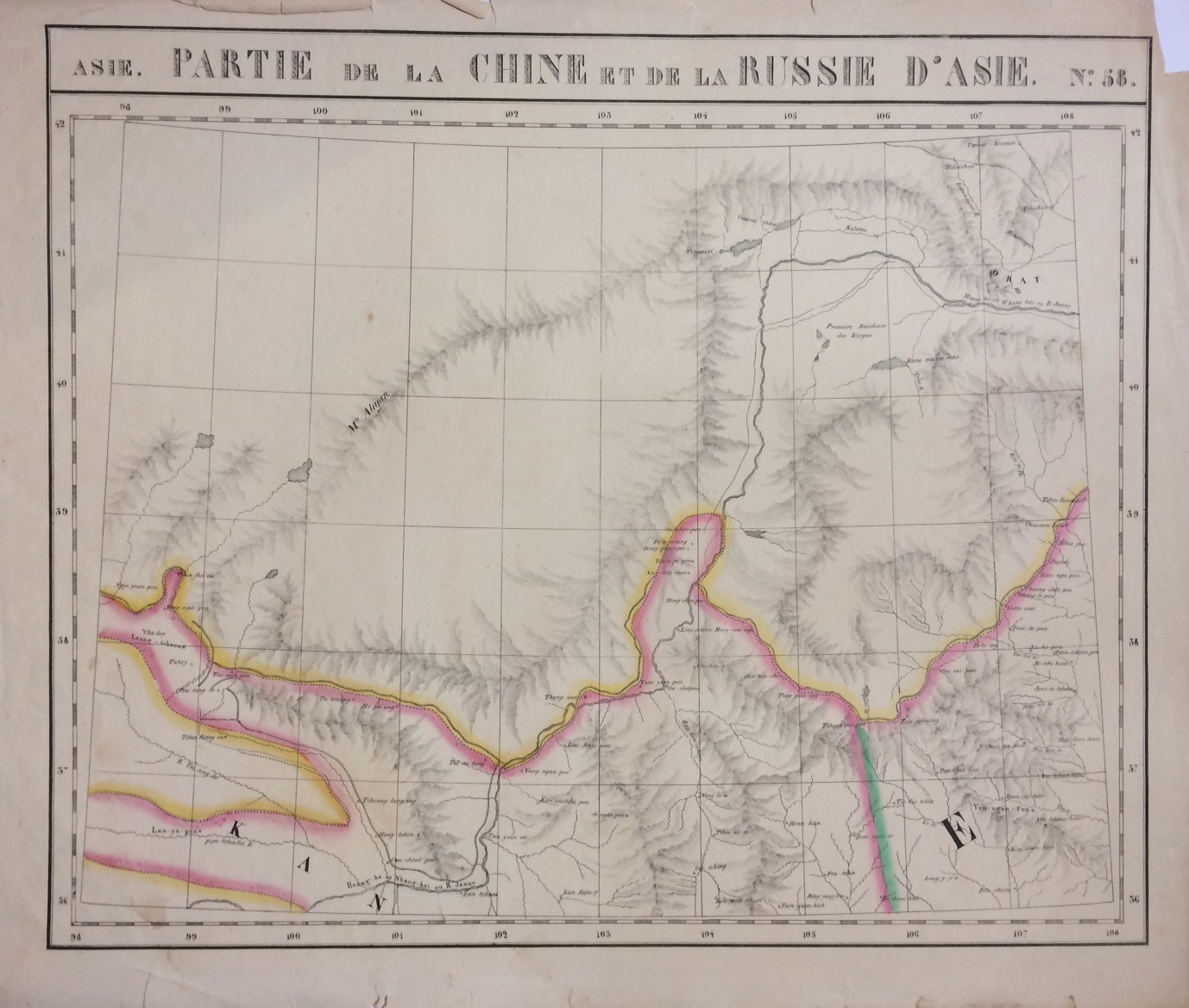
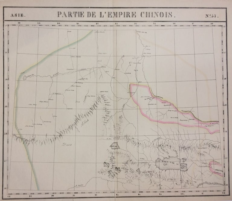
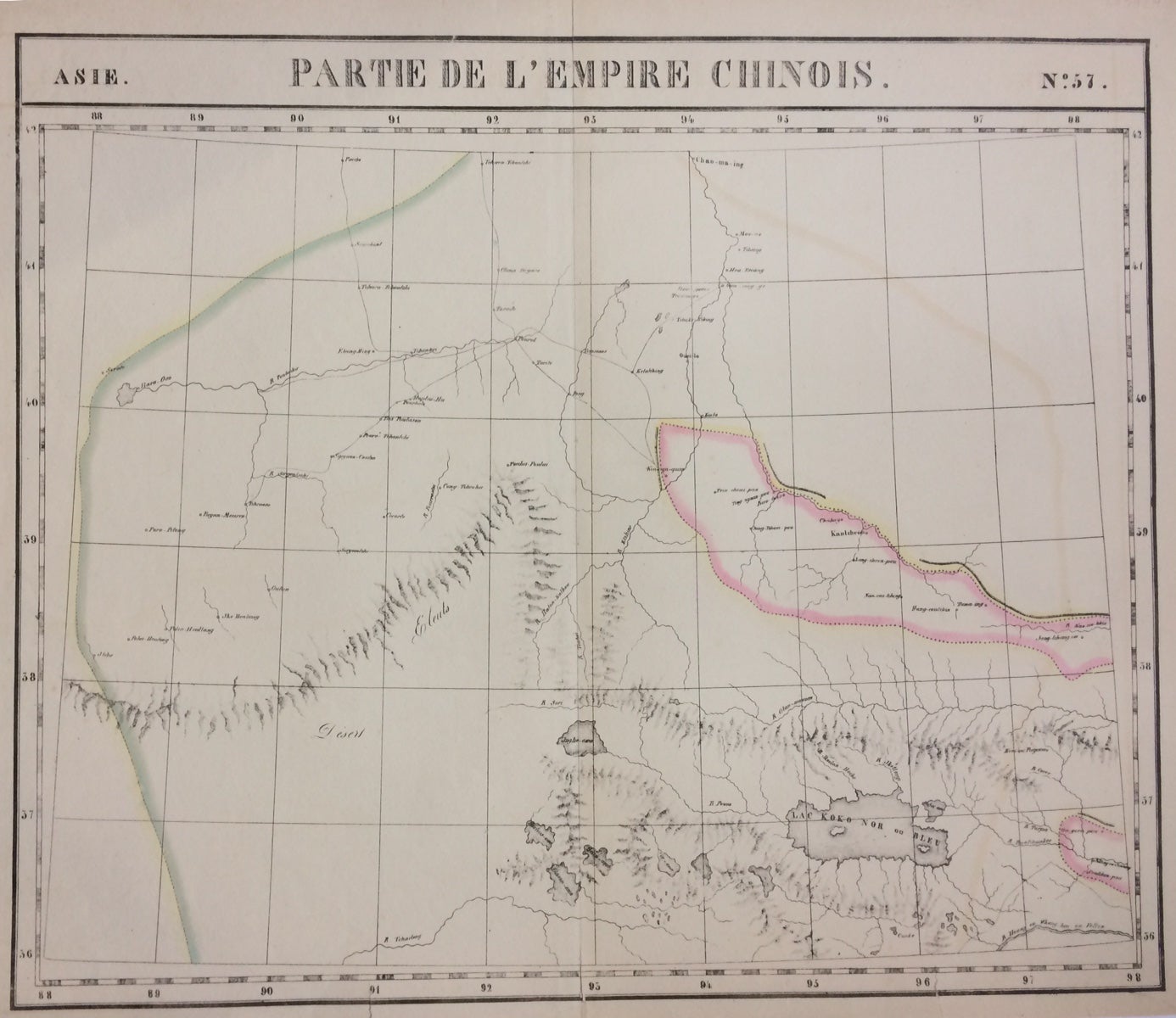
Asie. Partie de la Chine. Nos. 57 & 58
Brussels: Vandermaelen, Phillipe Marie, 1827.
Map (diptych). Two double-page lithographs with original hand outline color. Each image measures 18.75" x 19 1/8". Sheets measure 21" x 27". Both show some foxing, and some chips and tears to edges.
Beautifully detailed map that shows northwest China, including parts of the Silk Road. Mountains are delicately treated with hachure marks and major rivers and waterways are also shown. From Vandermaelen's 6 volume "Atlas universel de geographie physique, politique, statistique et mineralogique, sur l'echelle de 1/16411836". The atlas was the first to map the world on a uniform scale; maps were meant to join together to form a huge globe.Phillippe Marie Vandermaelen (1795-1869) was a Belgian cartographer and publisher. This map is a fine example of his work.
Binding: Unbound
Condition: Very Good
Language: English
Price: $500.00
Item #283424