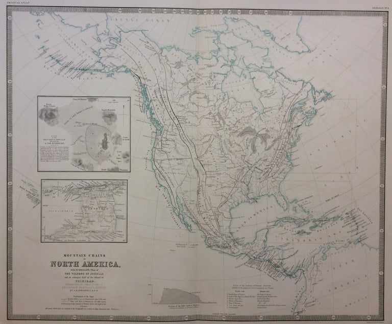
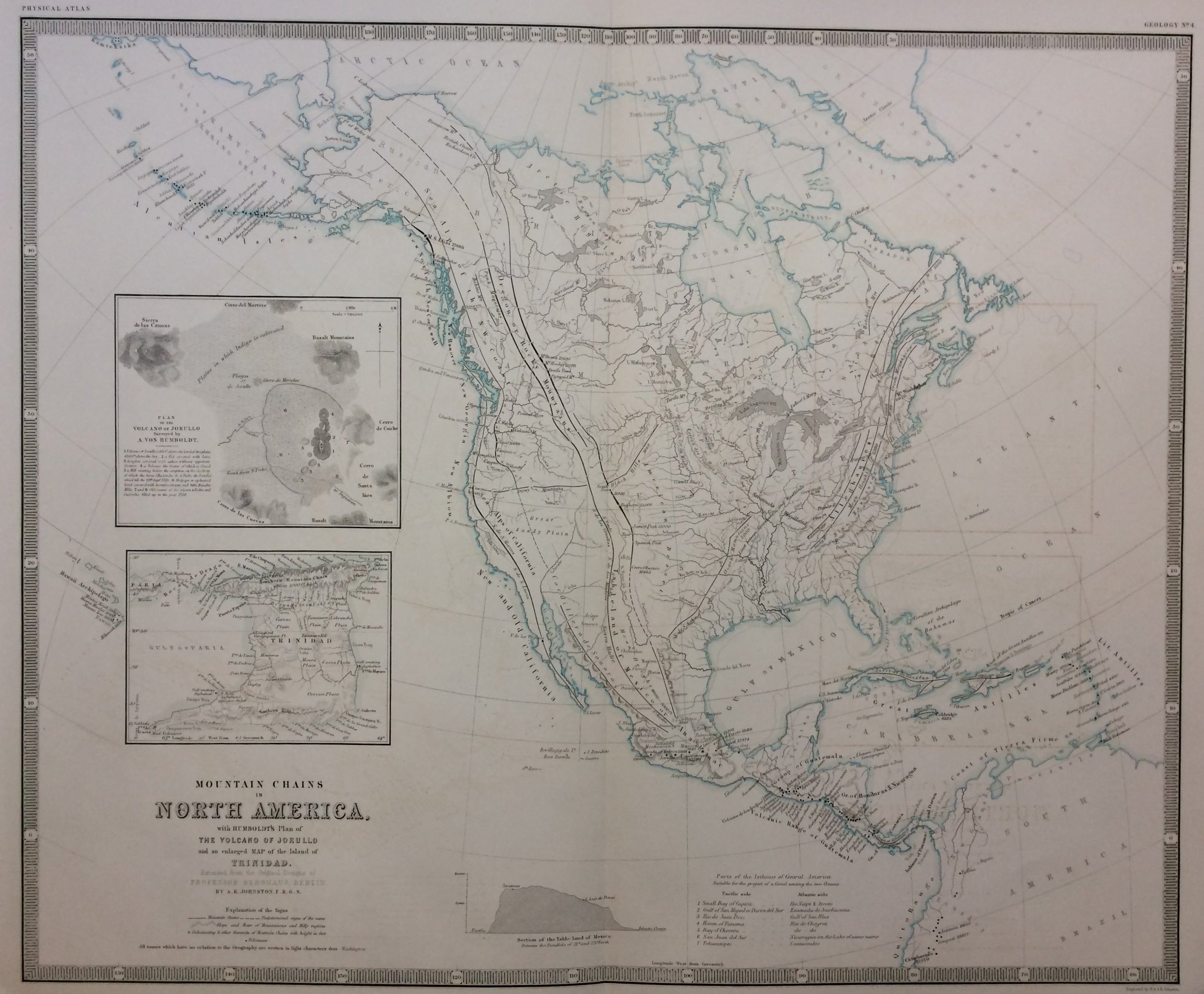
Mountain Chains in North America; with Humboldt's Plan of The Volcano of Jorullo and an enlarged map of the Island of Trinidad.
Edinburgh and London: William Blackwood and Sons, 1849.
Map. Engraving. Image measures 18.5 x 22.75 inches. Sheet measures 21.5 x 25.75 inches. In very good condition. Shows some light damp-staining. Engraved by W. and A.K. Johnston.
This fascinating and informative map describes the orography--the formation and relief of mountains--of North America based on recent scientific surveys. In the body of the map, black lines indicate mountain chains, and dashed lines indicate undetermined mountainous regions. Minute hachures delicately describe the slope and base of hills and mountains, open circles indicate their summits, labeled with height, and closed circles indicate volcanoes. The map is finely engraved such that all of this information, in addition to rivers and city names, is easily legible. Furthermore, the map contains informative insets and charts including a geological map of Trinidad that shows geological regions, and the plan of the volcano of Jorullo. The map also shows a profile map of the Table-land of Mexico, and 'Parts of the Isthmus of Central America Suitable for the project of a Canal uniting the two Oceans". As the map indicates, all of this information is extended from the original designs of Professor Berghaus of Berlin. The map was published in Johnston's "Physical Atlas." It is on bright paper and in good condition. Alexander Keith Johnston (1804-1871) was a Scottish geographer and Fellow of the Royal Geographical Society. Partnered with his brother William, Johnston maintained a prolific map publishing firm throughout the 19th century. Their output ranged from globes to atlases and wall maps. This map is a lovely example of Johnston's work.
Binding: Unbound
Language: English
Price: $375.00
Item #281003