
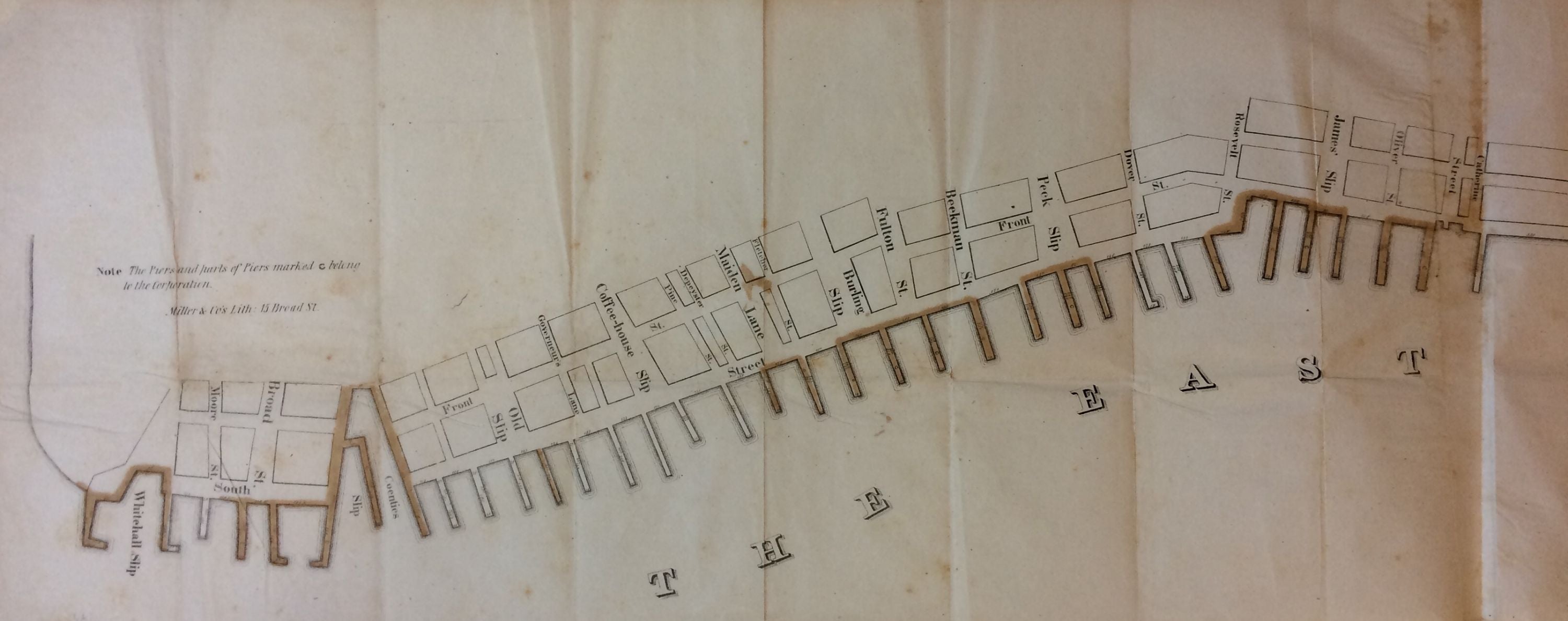
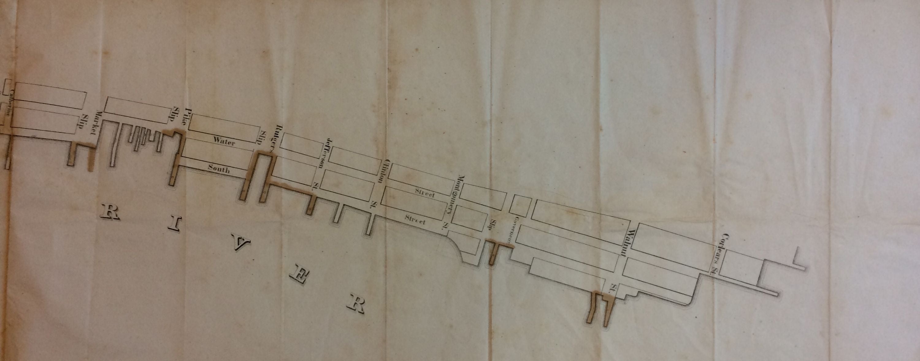
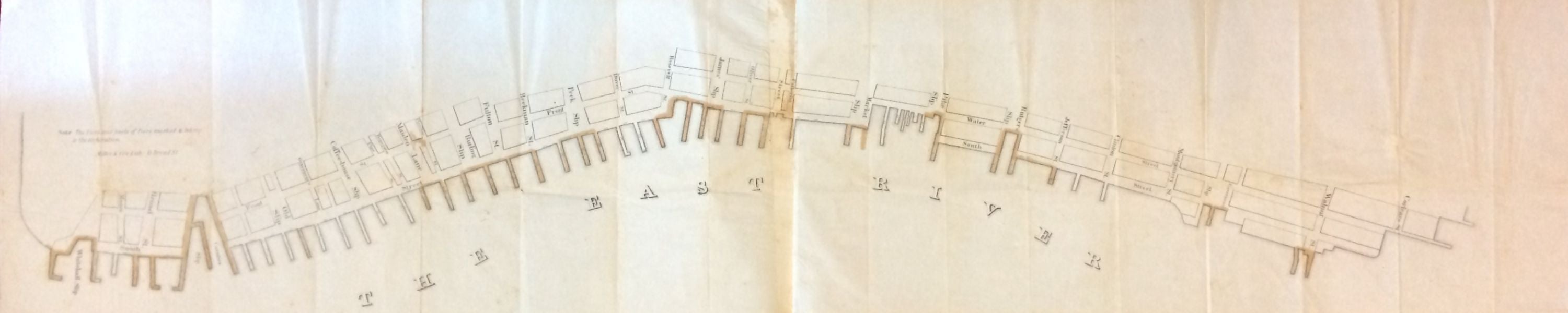
Piers and Parts of Piers marked C belong to the Corporation; Rare map of the Piers of the East River, Manhattan, New York City
Miller & Co.
Map. Lithograph with original hand coloring. Sheet size 13.25 x 60.75 inches.
This rare and beautiful circa 1840s map by Miller and Co. depicts the southeast shoreline of Manhattan along the East River. Extending from Whitehall Slip to Corlears St., it marks the piers and parts of piers belonging to the Corporation, which are marked with a 'C' and are colored in.
Depicts the old slips from Whitehall Slip to Governeur Slip, including Coentis Slip. The many slips created along the East River were an important part of the city that depended primarily of maritime trade. With larger ships being built, the slips offered limited space and piers and wharves were built out into the river. The slips would still continue to be used for smaller vessels. Over time the slips were filled in and by the mid-nineteenth century, all but one slip remained. Coentis Slip, a favorite docking place for many barges that came through the Erie Canal down the Hudson, was filled in by the end of the century. Today, some of the old slips exist in name only, a reminder of the old city of New York.
The map is in very good condition. Shows some foxing and wear along original fold lines.
Binding: Unbound
Language: English
Price: $1,850.00
Item #280353