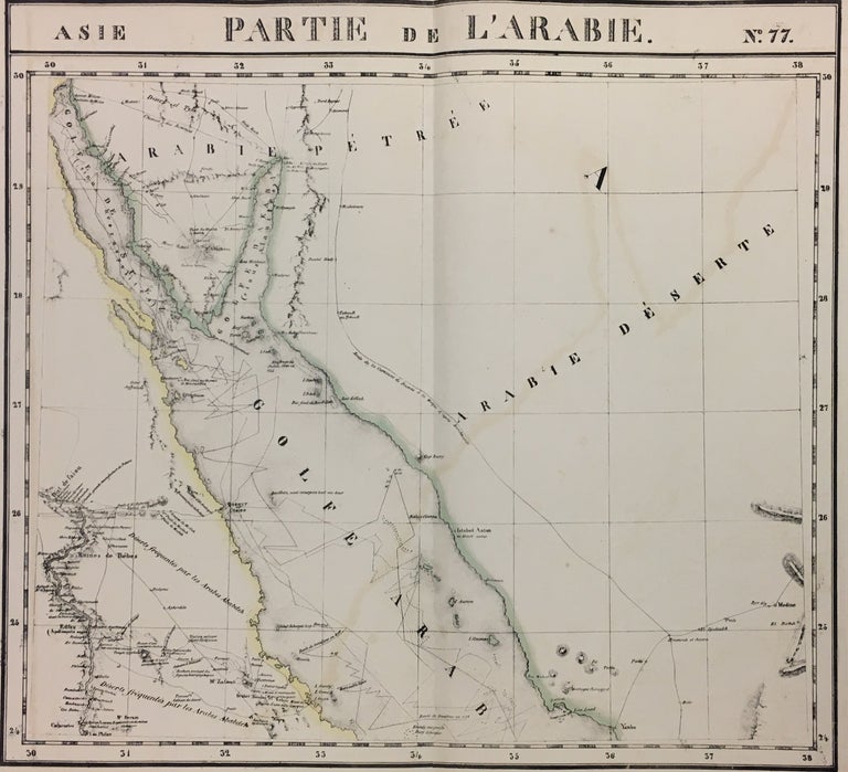
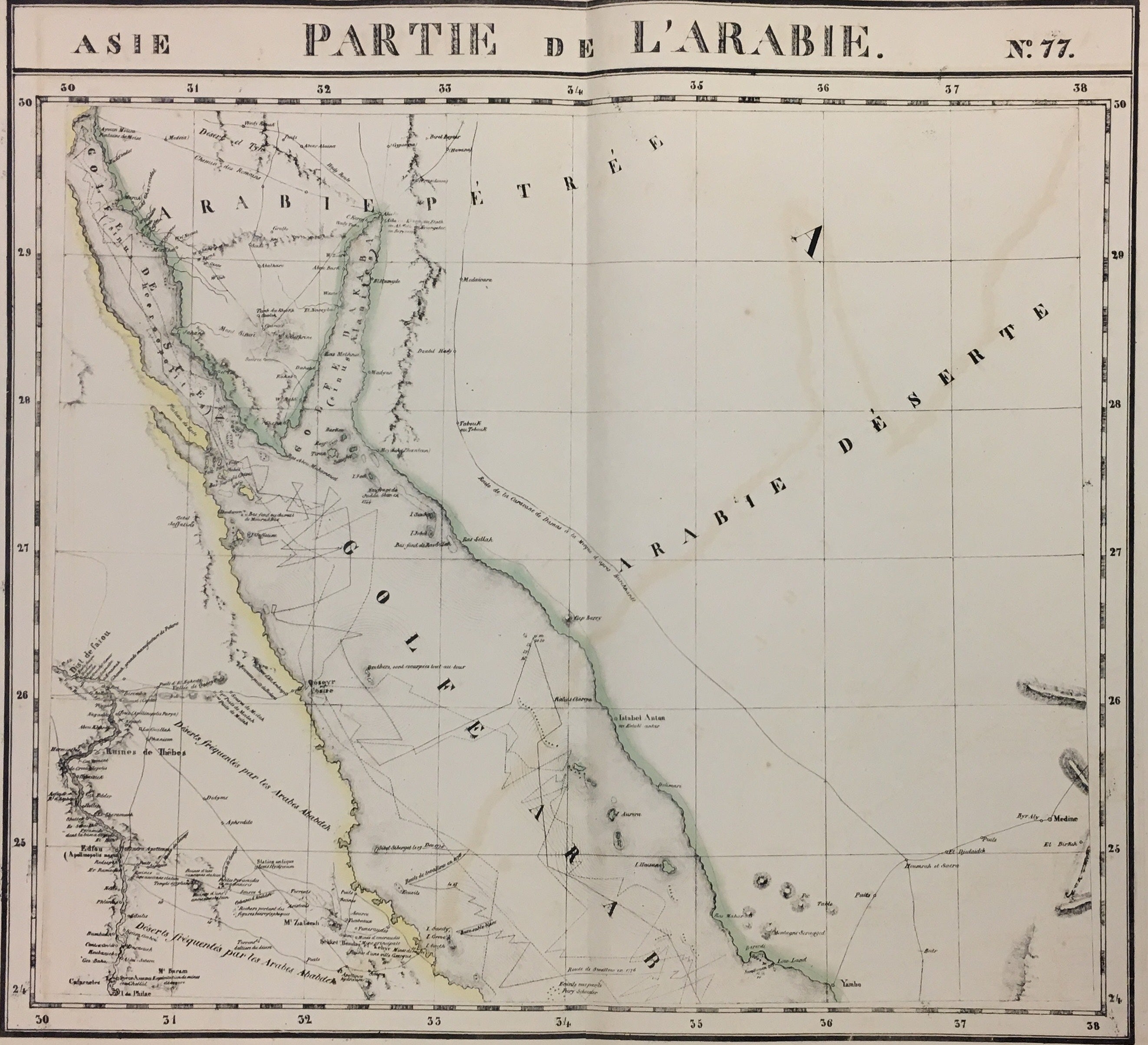
Partie de l'Arabie. Asie. No. 77
Brussels: Vandermaelen, Phillipe Marie, 1827.
Map. Large format lithograph with original hand outline color. Image measures 18 1/4" x 20".
Detailed map of the Arabian peninsula showing explorers routes. Includes Egypt, Saudi Arabia, Jordan and Israel. Mountains are delicately treated with hachure marks and major rivers and waterways, including the Nile and the Red Sea is called the Gulf of Arabia. From Vandermaelen's 6 volume "Atlas universel de geographie physique, politique, statistique et mineralogique, sur l'echelle de 1/16411836". Can be combined as gores to form an immense globe. The atlas was the first to map the world on a uniform scale.
Binding: Unbound
Language: English
Price: $500.00
Item #280267