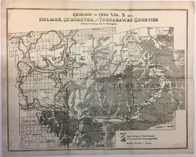
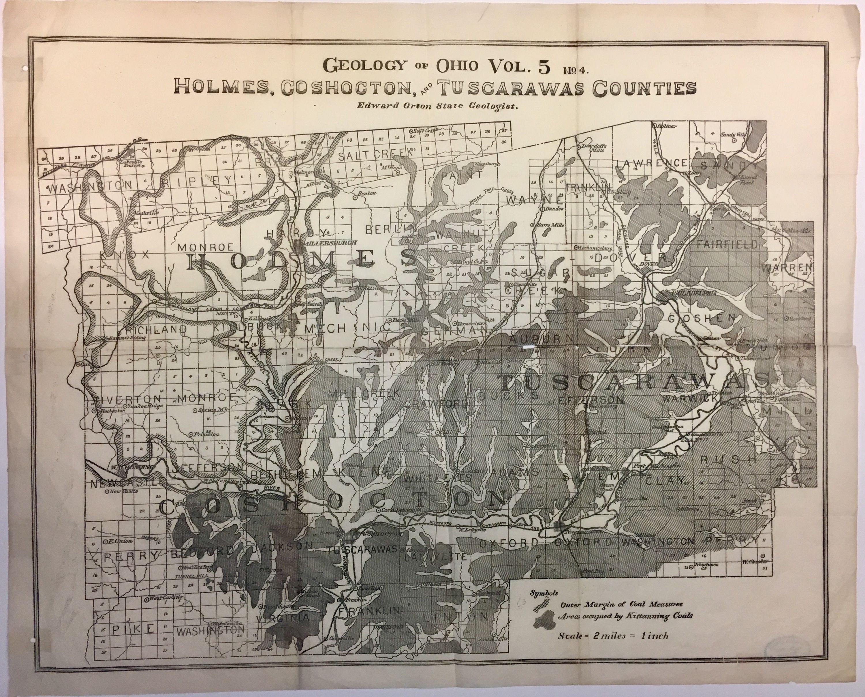
Geology of Ohio Vol. 5 No. 4. Holmes, Coshocton, and Tuscarawas Counties; Black diamond map
Edward Orton, 1884.
Map. 20" x 25 1/2".
This rare 1884 geological map by Edward J. Orton depicts the three counties of Holmes, Coshocton and Tuscarawas in Ohio. Focusing primarily on coal, the map shows the location of the Kittanning Coal seams. Railways, rivers and other topographical features are noted. These were economically important coal seams in the Appalachia region of Ohio. Many towns and villages in southeast Ohio grew up around the mining of the Middle Kittanning coal vein. Many of these are known as the "Little Cities of Black Diamonds."
The map is in good condition with minor wear and verso repair along the original folds. American Museum of Natural History stamp verso. Minor foxing.
Language: English
Price: $350.00
Item #280236