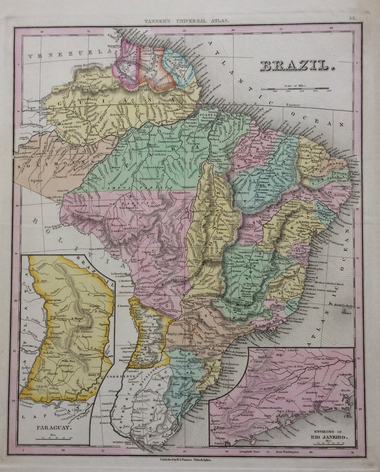
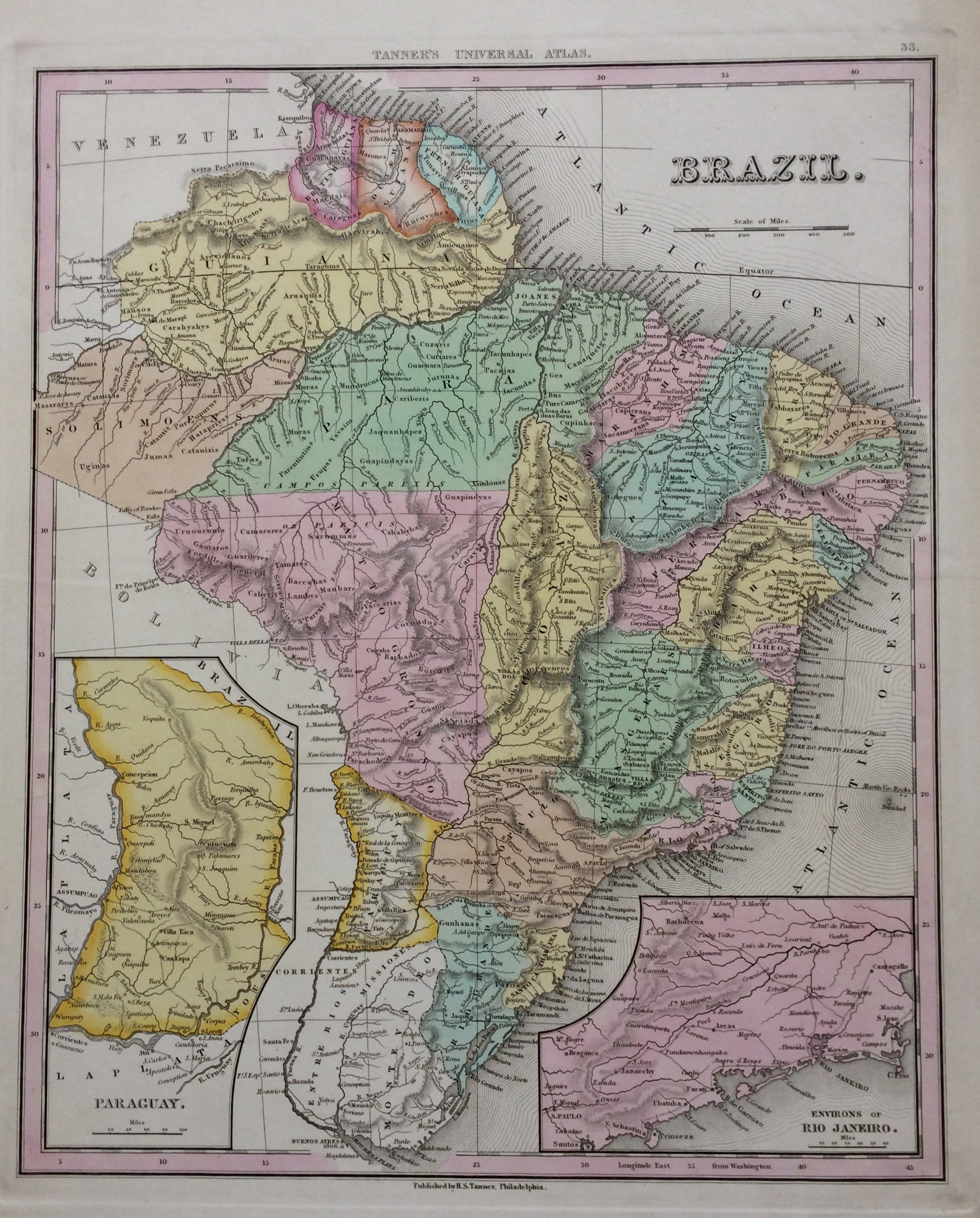
Brazil
Philadelphia: Tanner, H.S.
Map. Engraving with original hand coloring. Image measures 14.25 x 11.5 inches. Page measures 17.25 x 13.25 inches.
This 1839 map provides geographical, topographical, and political information about the Empire of Brazil. Large but sparsely populated, the country at this time enjoyed a general stability that manifests here in Tanner's dignified rendering. Hand coloring distinguishes provinces, while hachures show relief. In addition to capitancies and major cities, ports, islands, and other coastal features are also labeled. An inset of the Environs of Rio and an inset of Paraguay are included. Henry Schenck Tanner (1786-2858) was an American cartographer and statistical geographer. Born in New York, he moved to Philadelphia where he established his well-known publishing company with his brother. Tanner was the first American to publish a map of Texas, which subsequently went through eight editions. However, he is best known and most renowned for his New American Atlas. This fine map of Brazil is a wonderful example of his work.
Binding: Unbound
Language: English
Price: $125.00
Item #279742