
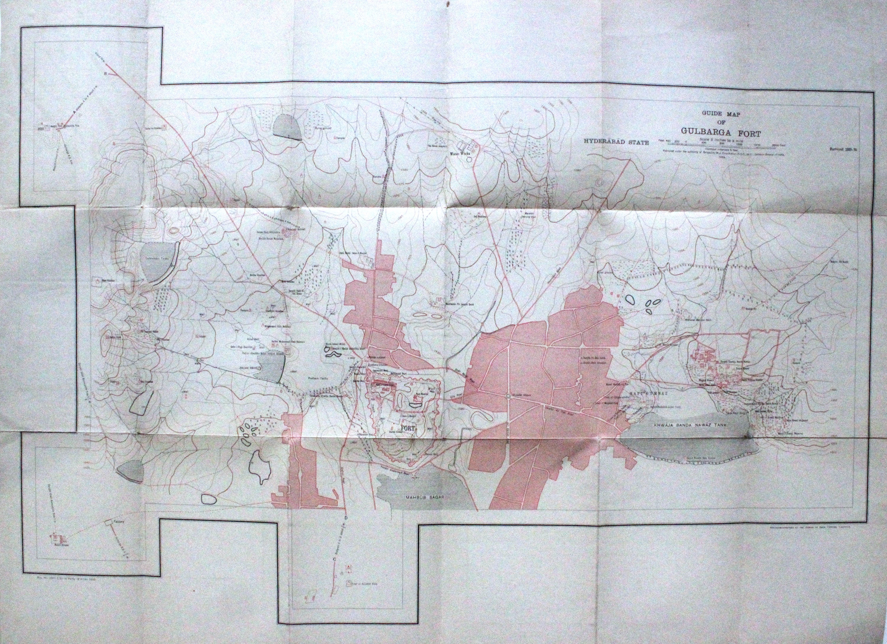
Guide Map of Gulbarga Fort
India: Survey of India, 1934.
Colored offset Lithograph. Sheet maps 22" x 29.5".
This 1934 pocket map depicts the plan of the Gulbarga Fort and vicinity located in the northern part of the state of Karnataka (at the time, Hyderabad State) in southern India. Beautifully detailed, the map notes the fort, important roads, lakes, wells, vegetation, and a host of other topographic elements.
Originally built by Raja Gulchand, a feudatory of the Warangal Kakatiyas, it was further fortified and enlarged in 1327 by Sultan Al-ud-din Bahmani of Bahmani Sultanate in 1327 and Adil Shah. Various monuments such as mosques, palaces, tombs and other structures were also built. Most notable of these is the Jami Masjid, built on the lines of the Great Mosque of Cordoba in Spain, is one of the first mosques in southern India. The fort remained the capital of the Bahmani Kingdom until 1424. Later the fort would be razed by the Vijaynagar Emperor and subsequently rebuilt by Yusuf Adil Shah, the founder of the Bujapur Sultanate.
This map was published under the authority of Brigadier H. J. Couchman, Surveyor General of India. It is in good condition with minor wear along the original folds and some offsetting. The map is lined with silk.
Language: English
Price: $365.00
Item #275256