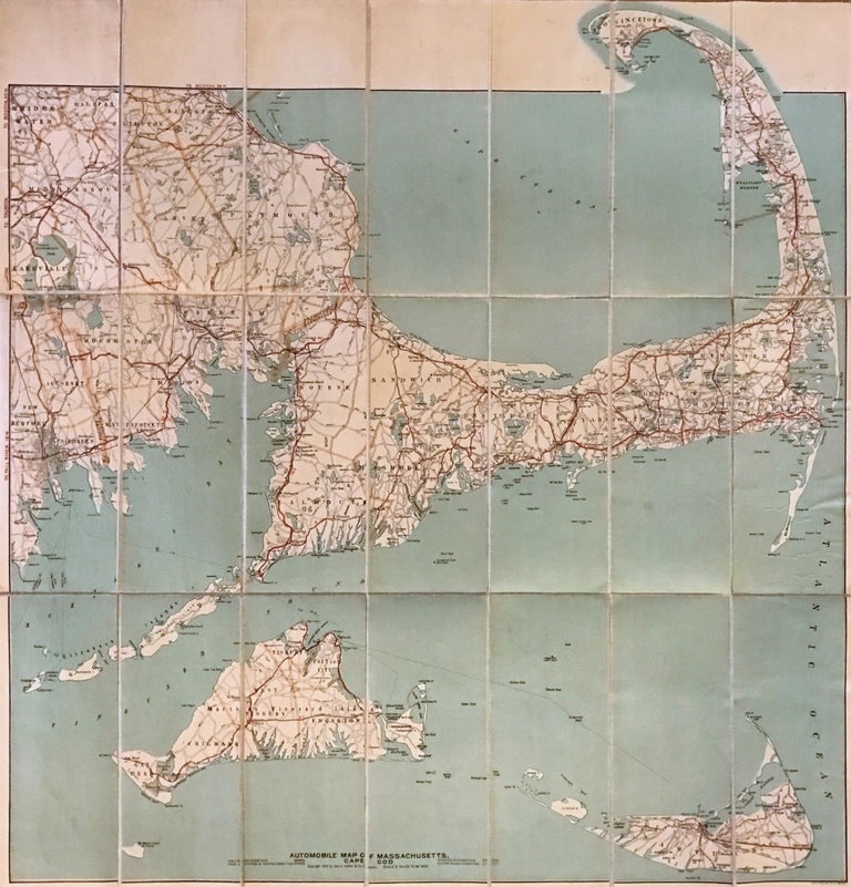
Automobile Map of Massachusetts Cape Cod Section
Boston: Geo. H. Walker & Co., 1906.
Map. Colored lithograph. Sheet measures 30.5" x 29.5".
This beautiful 1906 pocket map of Cape Cod, Nantucket, and Martha's Vineyard from 1906 was issued by George H. Walker & Co. Specifically designed for the automobile traveler, it identifies state roads, good automobile routes, electric railways and other routes. Covers from Bridge Water to Nantucket Island. Beautifully detailed, it also notes several towns, cities, bays, islands, ferry routes, lighthouses, shoals, banks, and several other topographical features. The map is in good condition with minor foxing. The map is dissected into 21 panels and backed with linen. Cover includes manuscript text. A list of other maps by Geo. H. Walker & Co. is also included on the back cover.
George H. Walker & Company was a publishing firm in Boston in the late 19th and early 20th centuries. George H. Walker and Oscar W. Walker started the firm in 1880 and were known for travel maps of New England. This is a beautiful example of their work.
Binding: Unbound
Language: English
Price: $675.00
Item #274408