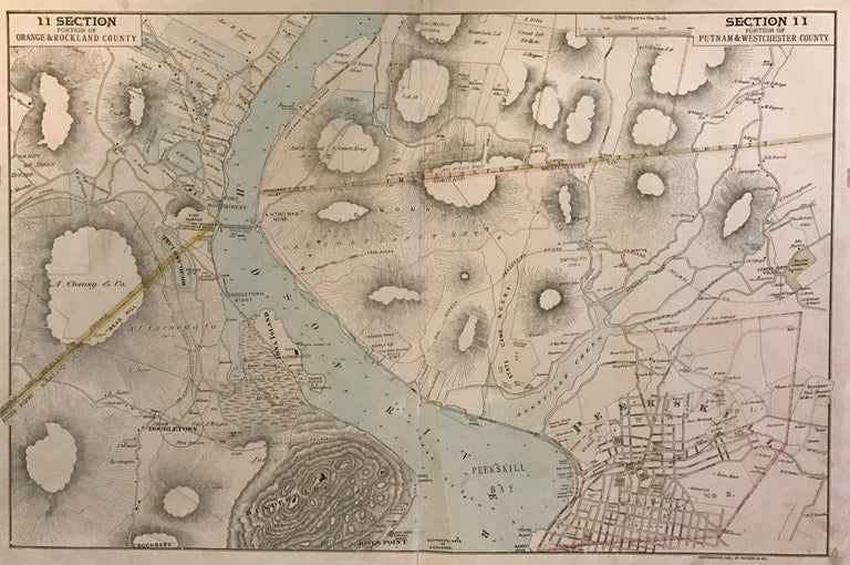
Portion of Orange & Rockland county. Portion of Putnam & Westchester County
New York: Watson & Co., 1891.
Map. Lithograph with original hand coloring. Sheet measures 20.25" x 30.5".
This uncommon 1891 map by Frederick W. Beers covers Orange, Rockland, Putnam and Westchester Counties in New York. The map beautifully renders elevation, meadows and other topographic features and notes streets, wards, settlements, wards, major buildings, landowners, bridges, wharves, railroads, cemeteries, etc. Includes Peekskill, Fort Montgomery, Fort Clinton, Doodletown, etc.
The map was included in Watson and Co.'s "Atlas of the Hudson River Valley from New York City to Troy. In good condition with minor wear along the original centerfold and minor edge wear. Linen backed, as issued.
Frederick W. Beers (flourished 1858-1929) came from a family of surveyors, cartographers and publishers originally from Newtown Connecticut. F.W. Beers continued the work of his father James Botsford Beers and was known for his county survey maps of New York, Ohio, Pennsylvania, Michigan, Connecticut and Vermont.
Binding: Unbound
Language: English
Price: $250.00
Item #273779