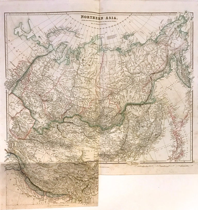
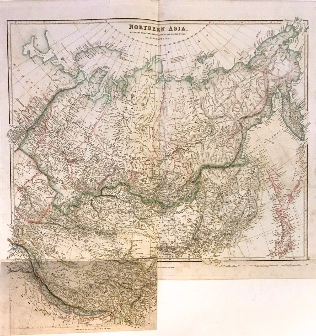
Northern Asia From the Himalaya Mountains to the Arctic Ocean
London: Arrowsmith, John, 1840.
Map. Engraving with hand outline. Sheet measures 21.5" x 27.5 with bottom flap open, measures 25.75" high.
This unusual 1840 map by John Arrowsmith covers northern Asia in incredible detail. It extends from the Arctic south to include Tibet, which is shown here on an overlay pasted in the bottom left. Notes several routes of explorers throughout. Numerous cities, towns, rivers, lakes, islands, mountains, deserts, and a host of additional topographic features are identified. Outline color shows various territories and borders including Mongolia, Tibet, Manchuria, Japan, etc. The ancient capital of the Mongol Empire of Genghis Khan is identified at Kara Korum in Mongolia.
In good condition with offsetting throughout and minor foxing. Folds show minor wear. Top margin features verso repair, not extending over image. The overlay of Tibet was published in 1934 while the larger sheet was published in 1840.
John Arrowsmith (1790-1873) was from a family of London based cartographers and publishers, and was a founding member of the Royal Geographical Society. His "London Atlas," known for its understated elegance, is considered one of the first truly "modern" atlases of the nineteenth century. This map is a fine example of Arrowsmith's work.
Binding: Unbound
Language: English
Price: $450.00
Item #272359